As we’ve discussed a few times, water is a remarkably scare resource in many parts of the world, and Google Earth has proven to be a great way to learn more about the problem. A great example is the UNICEF: Water and Sanitation layer that was released a few years ago.
The folks at WaterAid have recently developed a Mapping tool called the Water Point Mapper. It takes data via Microsoft Excel and uses macros to generate KML files. The tool is now widely used by WaterAid country programs and partner organizations across sub-Saharan Africa to map rural water points. The tool empowers communities to manage their water sources and offers district level planning and resource allocation.
The Mapper can generate a range of point based and area based maps for monitoring a wide selection of status indicators. The list includes water source coverage (with and without functionality), functionality, water source type, revenue collection and access distance. Also a range of water quality parameters can be mapped, such as fluoride and iron. It can be configured for use in any country, as long as you can provide them with the necessary shapefiles for district and sub-district administrative levels.
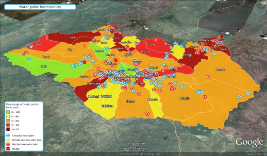
There aren’t any sample files on the site, but they were kind enough to produce a few of them for us that you can check out. The first is a fairly standard map (KMZ file ):
):
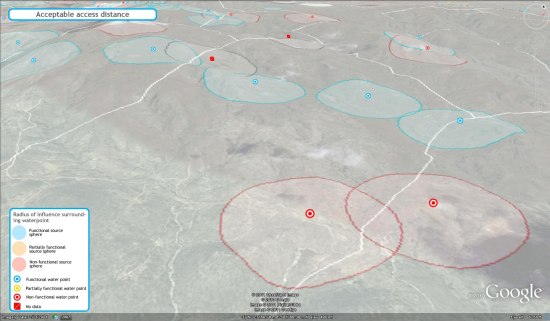
The next is a map that features “radius of influence” spheres, so you can see how much area each specific water distribution point is able to affect (KMZ file):
For more info, check out their site at www.waterpointmapper.org.