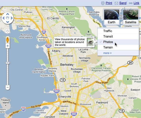
When we launched Google Maps, we had one layer — the map. Since then, we’ve added more than ten different ways to explore the world around you, including photos, transit and traffic information, as well as satellite and terrain views. We’ve now updated the design so that you can more easily see and switch between the various viewing options that are available.
Suppose you’re planning to meet your friend for a concert at the Greek Theater in Berkeley, and you want driving directions to plan your trip from your apartment in San Francisco. When accessing Google Maps, you’ll see a new widget in the upper right corner that allows you to easily select from either the Maps, satellite or Earth view. In addition, the single widget icon showcases all the different layers available to you, enabling you to quickly see more detailed information just by mousing over the ones you want.
Since it’s nearly rush hour and traffic information would be useful, you select that layer by clicking on it in the widget:

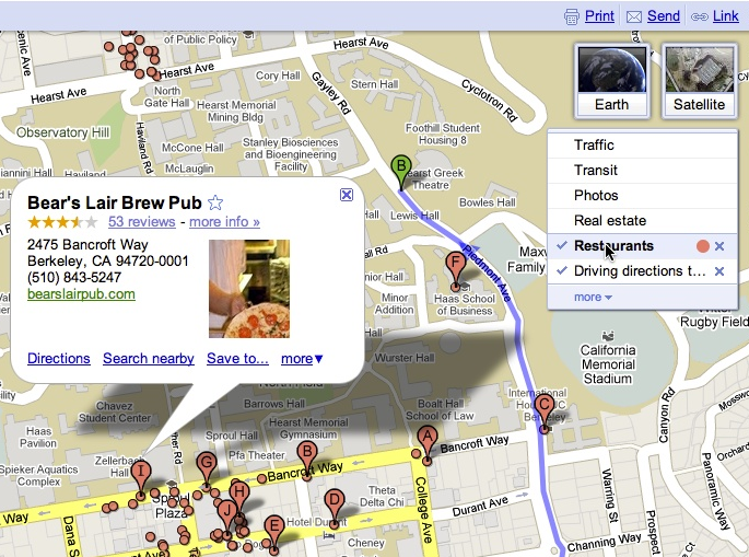
Unfortunately, the traffic layer shows that there are heavy delays along your route. You wonder if taking public transit is a better option, so you turn off the traffic layer by clicking on it again, and turn on the transit layer instead:

Ah, it looks like there’s a Bay Area Rapid Transit (BART) station near your apartment and one near the Greek Theatre. Public transit it is! If you also want to find a local spot to grab dinner after the show, you could search for [restaurants] in the same Google Maps window. Your recently viewed searches will appear in the new widget, enabling you to easily see both your destination and search results at the same time. This makes it easy to find a place nearby.
We hope this new all-inclusive widget for accessing map types, layers and recently viewed searches improves your experience exploring and navigating to the places you want to go!