For more than five years, since we first learned of Panoramio, photos have been a big part of Google Earth. Being able to fly around and view geo-referenced photos in Google Earth is a great experience. Today, that experience got better.
Google has just enhanced the photos layer with clusters, making it much easier to find and browse photos on the map. To get started, make sure that you’ve enabled the Photos layer in the left layers panel, and then zoom in anywhere on earth. As you get closer, you’ll see icons begin to appear; click one, and you’ll see a screen similar to this:
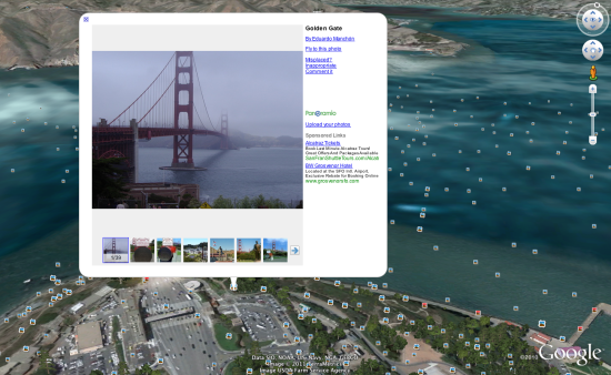
You can then click any item int he filmstrip to quickly view it, or use the left/right arrows on your keyboard to browse through them.
As always, you can add your own photos to Google Earth by simply uploading them at Panoramio.com.