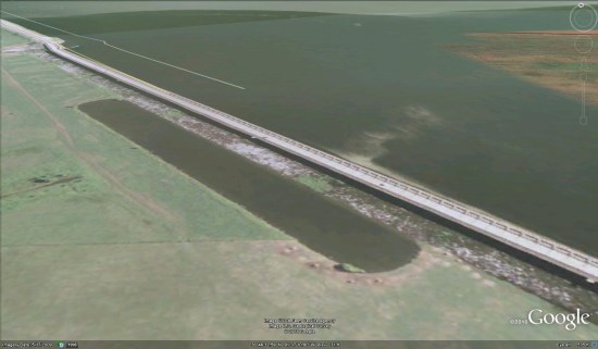
As many of you have likely heard about, the Morganza Spillway in Louisiana was opened yesterday afternoon to intentionally flood hundreds of homes, in the hopes of saving thousands of homes further south. You can view the spillway using this KMZ file (via ‘Textularia’ at the GEC), seen here:
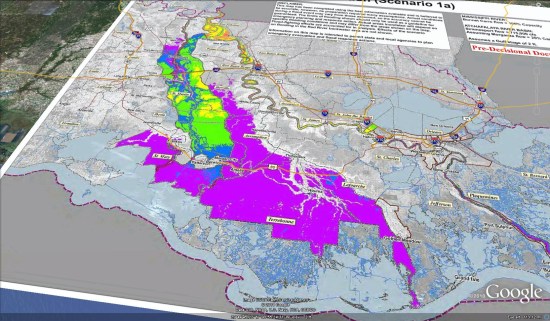
At this point, the Corps of Engineers are planning to use Scenario 1A, which keeps the spillway open at 1/4 of its maximum, a rate of roughly 150,000 cubic feet per second.
The results of that can be seen in their Potential Inundation image, viewable in Google Earth via this KML file or seen here:
This type of flooding is a known risk for those that live in the area, but it’s still heartbreaking for people to watch their homes be destroyed. Hopefully this effort will pay off and the New Orleans levees can withstand the pressure from the river over the next few weeks.