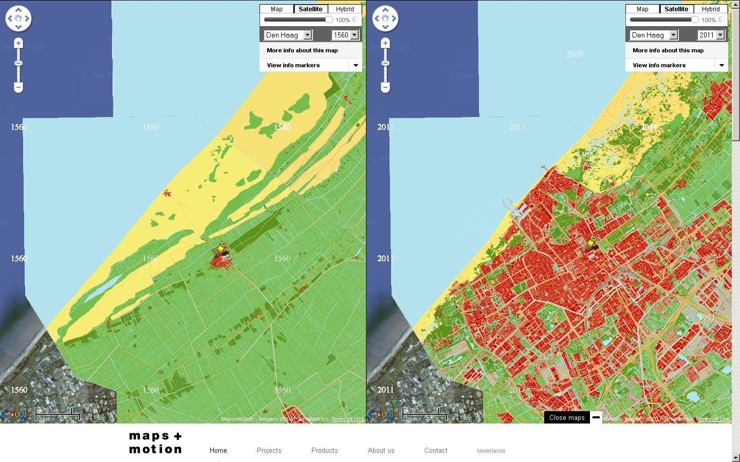
Mapsplusmotion is making a digital historical atlas which shows at a glance how a city or a country has grown and changed over the centuries. The digital historical map forms the basis for educational presentations, and interactive and online applications. The applications of Mapsplusmotion are particularly suitable for educational projects in museums and historical-geographical access to heritage collections. As well as animation films and a custom-made historical layer in Google Maps, we supply interactive educational applications and printed material.
