A few days ago, the eastern United States was hit by a magnitude 5.8 earthquake. The quake did relatively little damage, though it was felt by a large portion of the country.
Data Appeal, has built a few files to show the severity and reach of the earthquake.
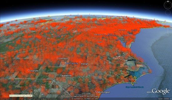
The first KMZ file uses transparent spheres with volumeric values, similar to the demos we have seen from DataAppeal in the past.
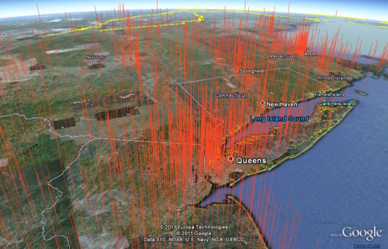
Their second KMZ file shows the data with tall orange spikes, built using real data with dramatized height.
These files are a great example of what companies like DataAppeal are capable of, as well an excellent way to show how fast they work. Being able to plug data into a system like that and get these kinds of results could be a powerful tool for a lot of organizations.