In 2006, a tool from Jeremy Cothran at the University of South Carolina that provided a ton of near real-time weather data from various sensors around the southeastern United States.
Jeremy has now taken that vast amount of data, and simplified it to highlight significant events among those sensors. In particular, it highlights wind gusts over 30 mph or wave heights over five feet. The result, when combined with other tools such as Google’s built-in satellite overlay, can be quite useful.
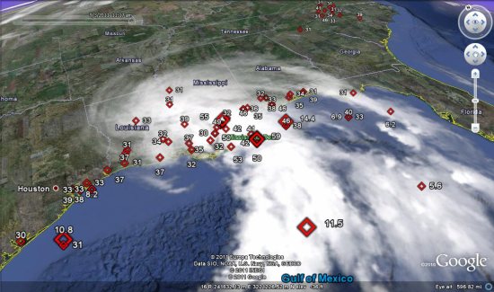
The more significant events are shown using larger icons, making it easier to see where the heart of the action is. You can also view the data using Google Maps, but it loses the label styling and time slider functionality.