GeoEye and Google have teamed up to release some sharp new imagery from the wildfires in Texas. Here’s a quick look at some of this amazing new imagery:
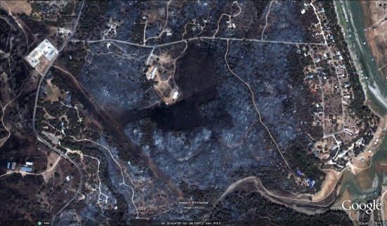
You can browse the fresh imagery using this KML file . Storyful has a nice write-up about the imagery, including a lot of before-and-after shots for various parts of the state.
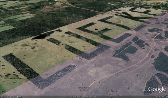
A fun side-note of this story is that we can see that “LUECKE” still exists. The area of the carved out letters, formed by clusters of trees, is nearly 2.5 miles long. As you can see below, the new imagery from GeoEye includes the bottom strip of the letters, showing that it’s still quite well-defined.