What if someone were to create a map that showed every street in the country and nothing else? Fathom Information Design did just that, and the results are amazing!
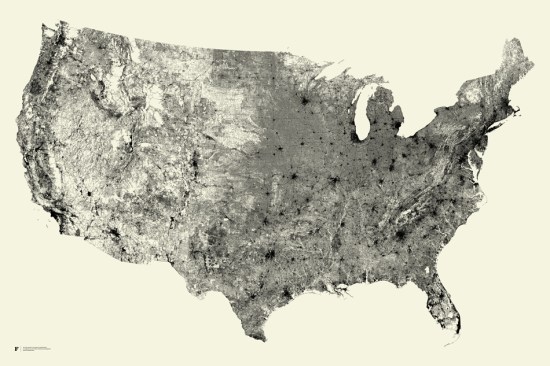
It feels kind of like the city lights of Earth that we recently wrote about, as you can clearly see cities form without any kind of borders or other overlays in there.
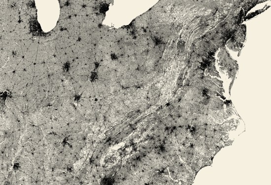
What’s even more remarkable about the “All Streets” map is how clearly the mountain ranges are defined. Simply by drawing in the roads, you can see them without any difficulty. A great example is the Appalachian Mountains, seen here:
You can view and/or purchase the map over on the Fathom website.
(via +Adrienne St. Aubin)