Greg’s Cable Map


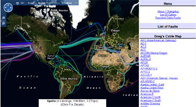
Greg’s Cable Map is an attempt to consolidate all the available information about the World’s undersea communications infrastructure on a Bing Map. The initial data for the map was harvested from Wikipedia, and further information was gathered by simply Googling and transcribing as much data as possible.

If you mouse-over any of the displayed cables on the map a brief description is displayed at the bottom of the map. If you click on the cable more details are displayed in the map sidebar and links are given to relevant websites.

Greg’s Cable Map

Route Savvy App – Bing Maps

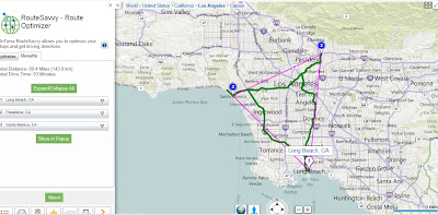
Whether you are going five or fifty places, the Route Planner app is a useful, unique map app that will get you from point A to Z in the shortest amount of time possible.Route Savvy App  Bing Maps

Find Shortest Routes or quickest routes with traffic and managing geocoding from Excel data.

How it Works

Route Savvy App Geocode - Bing Maps

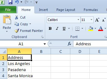
The first step is to add destinations on the map. “RouteSavvy” makes it easy to quickly add a few or 100 destinations – you can click locations on the map, enter addresses manually on the left-rail, or upload an Excel file with addresses on each row. For demonstration purposes, I’ve shown eight points below. Each time you add a destination, the map auto-zooms and centres so you can see all the destinations at once.

Route Savvy App Import Excel - Bing Maps

“General users likely have between three and ten destinations when they plan trips that could benefit from route optimization. The value of this tool for business use is amplified when businesses may have 25 or more destinations to reach in a day. Other services only allow up to 25 waypointsconsidering the Bing app can handle up to 100, we feel that we’ll be a strong choice for businesses who need great route optimization for lots of destinations. Realtor’s who have multiple showings in a day, any business that does deliveries, shuttle services, technicians, and florists – just a few examples – will find this to be a great tool to make their lives easier with the “RouteSavvy” app.”

View the new Map App: OnTerra’s “RouteSavvy” Route Optimizer

Azure SQL 2008 – Bing Maps – Near Route Demo

Azure SQL 2008 – Bing Maps – Near Route Demo

After the announcement http://bingmapswatch.blogspot.com/2010/03/bing-maps-sql-azure-support-april-2010.html that Azure SQL 2008 was implmenting Spatial Support (Geography and Geometry) this now enabled.

This is an example of combining, Windows Azuew, SQL Azure, Silverlight and Bing Maps to produce a find along a route example
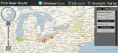
Windows Azure SQL 2008 Bing Maps Find Near a Route
Finding Petrol (Gas) Stations along a route (Boston to Chicago) within 1km (1000m) of the route.

The code inside Azure SQL 2008 doing this is

@myGEOM is the lat and lng (x1,y2)+(x2,y2) start and end points for the route
@myBuffer is the buffer distance (1000m default)
@myRoute is the (xy,xy,xy,xy) of the enitre route creating a polyline
This polyline is then buffered creating a polygon (area) around the route.
SQL 2008 Azure then uses Geoproccessing 'Buffer' and 'Intersect' to pull-out
any points (gas stations in this example) and then displays the points as markers
on bing maps

code:

 CREATE PROCEDURE [FindNearRoute] @myGEOM nvarchar(MAX), @myBuffer int
AS
   --Create the Buffer
   DECLARE @myRoute geography;
   SET @myRoute = @myGEOM;

   DECLARE @SearchArea geography;
   SET @SearchArea = @myRoute.STBuffer(@myBuffer);

   --Return all POI in the search area
   SELECT Lat, Lon, Name
   FROM PetrolStations
   WHERE (@SearchArea.STIntersects(GEOM)) = 1

Live Example (Silverlight required)
http://talkingdonkey.cloudapp.net/BM-SL-FindNearRoute/Default.htm

There is also a zip file (BM-FindNearRoute.zip) with all the source code required to create your own find near a route example.

Source
http://johanneskebeck.spaces.live.com/blog/cns!42E1F70205EC8A96!12533.entry