The Art of Maps: Jean Baptiste Bourguignon- A general map of the World or terraqueous globe with…

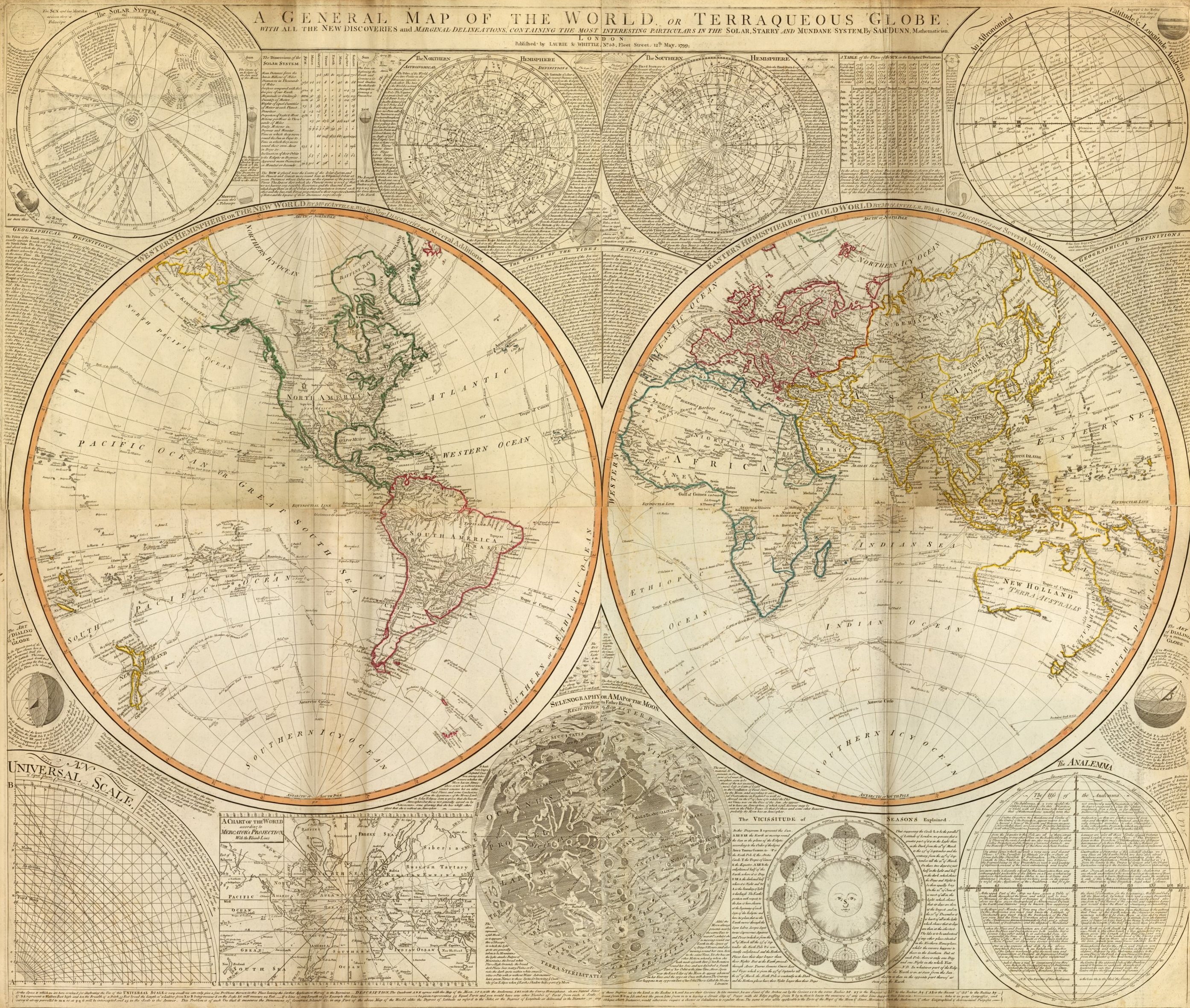
Jean Baptiste Bourguignon- A general map of the World or terraqueous globe with..
Author: Anville, Jean Baptiste Bourguignon d, 1697-1782; Dunn, Samuel; Riccioli, Giovanni Battista; Robert Laurie &
James Whittle
Date: 1799
Short Title: Composite: World.
Publisher: Laurie & Whittle London
Type: Composite Map
Obj Height cm: 105
Obj Width cm: 124
Scale 1: 43,000,000
Note:
Digital composite of north and south halves of hand colored engraved map. Relief shown pictorially. Contents: Western Hemisphere or the New World by Mr. d’Anville, with new discoveries and several additions — Eastern Hemisphere or the Old World by Mr. d’Anville, with the new discoveries and several additions. Ancillary maps or charts: The Solar System — The Northern Hemisphere — The Southern Hemisphere — An astronomical latitude & longitude analemma — An universal scale — A chart of the World according to Mercator’s projection, with the rhumb lines — Selenography or A map of the Moon according to Father Riccioli — The vicissitude of seasons explained — The analemma. Printed on 4 sheets; joined as 2.
World Area: World
Subject: Celestial
Full Title:
(Composite of) A general map of the World or terraqueous globe with all the new discoveries and marginal delineations, containing the most interesting particulars of the solar, starry and mundane system, by Saml. Dunn, mathematician. London, Published by Laurie & Whittle, No. 53, Fleet Street, 12th May, 1799.

Author: Anville, Jean Baptiste Bourguignon d, 1697-1782; Dunn, Samuel; Riccioli, Giovanni Battista; Robert Laurie &James WhittleDate: 1799Short Title: Composite: World.Publisher: Laurie & Whittle LondonType: Composite MapObj Height cm: 105Obj Width cm: 124Scale 1: 43,000,000
Note:Digital composite of north and south halves of hand colored engraved map. Relief shown pictorially. Contents: Western Hemisphere or the New World by Mr. d’Anville, with new discoveries and several additions — Eastern Hemisphere or the Old World by Mr. d’Anville, with the new discoveries and several additions. Ancillary maps or charts: The Solar System — The Northern Hemisphere — The Southern Hemisphere — An astronomical latitude & longitude analemma — An universal scale — A chart of the World according to Mercator’s projection, with the rhumb lines — Selenography or A map of the Moon according to Father Riccioli — The vicissitude of seasons explained — The analemma. Printed on 4 sheets; joined as 2.
World Area: WorldSubject: Celestial
Full Title:  (Composite of) A general map of the World or terraqueous globe with all the new discoveries and marginal delineations, containing the most interesting particulars of the solar, starry and mundane system, by Saml. Dunn, mathematician. London, Published by Laurie & Whittle, No. 53, Fleet Street, 12th May, 1799.

The Art Of Maps:

Geography as art

While maps are often considered guides to get from here to there, on the Google Maps and Earth team, we’re constantly thinking of innovative ways to express geographic information. From helping you see the world from a street-level perspective with Street View, to enabling you to dive into the Ocean layer in Google Earth, new geographic visualizations are top of mind for the team. With that mapping mindset, Group Product Manager Lior Ron was struck by the abstract landscape paintings he saw at the Sausalito art festival.

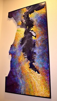
Ben Joyce’s painting of San Francisco caught his attention: “The color scheme, brush strokes, and the open frame prompted my imagination freely to think about San Francisco and what I love about this city. What a wonderful way of visualizing spaces!”
San Francisco at Night by Ben Joyce
Ben describes his work as Abstract Topophilia: “The affective bond between people and place. The Love of Place,” and explains how cities like San Francisco inspire his artwork: “There is great beauty and intrigue in the layout of a city – from your everyday drive to work, to the historical creation of the streets, to your personal relationship with the town.”
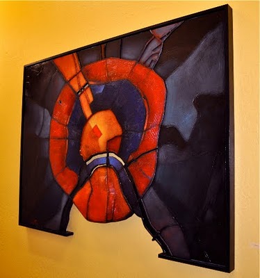
When Lior shared Ben’s work with some teammates, we too were fascinated by the bold color schemes and dramatic visualizations of geographic information, and were thrilled to learn that Ben has consulted Google Earth to create his city artwork. To share these creative visualizations with the team, we invited Ben to show some of his artwork in our team building, with depictions of cities ranging from Florence to Moscow.
Moscow by Ben Joyce
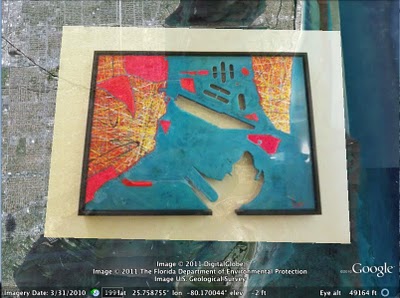
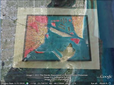
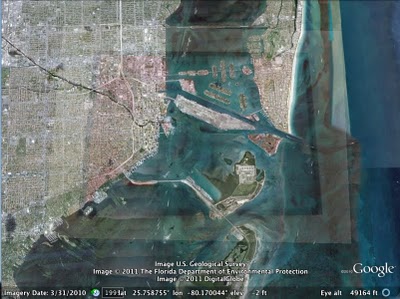
When we first hung up the paintings, we omitted location descriptions and opened a contest for the team: who could identify all of the paintings first? Google Earth Community Program Manager Robin Ziegler identified all of the locations about 30 hours after we started the challenge, and even plotted all of the paintings in Google Earth. Here you can see how Robin aligned Ben’s painting of Miami with the corresponding imagery in Google Earth.


Ben’s artwork will stay in our team’s building for the next three months, and will continue to remind us of the creative potential of geographic information.
Posted by Emily Henderson, Administrative Assistant, Google Maps & Earth

The Art Of Maps: Orbis Terrarum Typus… auctore Petro Plancio 1594

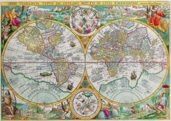
Orbis Terrarum Typus De Integro Multis In Locis Emendatus auctore Petro Plancio 1594

Map Maker: Petrus Plancius

Place / Date: Amsterdam / 1594

Coloring: Hand Colored

Size: 23 x 16 inches

Description: This spectacularly decorative map engraved engraved by the Dutch master Jan van Doetecum holds the distinction of being the first world map to use a style of richly decorated border that would dominate world maps for decades to come. The elaborate borders were inspired by drawings in the works of Theodore de Bry published a few years earlier and established a pattern of cartographical decoration that lasted over a century. The map also has great importance geographically, particularly in the mapping of the Arctic and the Far East. The map contains a marvelous attempt at a North-West Passage, and Plancius himself instigated the three voyages of Willem Barents (1594-1597) into the area. He used this map to give cartographic encouragement to the Dutch crews by turning Novaya Zemlya into an island with open sea between it and the Arctic. A sprinkling of English names in the Canadian Arctic appear as a result of Frobisher and Davis’s explorations in search of the passage in 1576-1587. The map is also a landmark in the mapping of Asia and Japan. Plancius was one of the first Europeans able to penetrate the wall of secrecy surrounding the manuscript portolan maps produced by Spain & Portugal. ” Some of the most significant improvements include the first incorporation of Teixiera’s outline for Japan.. Ususal fold reinforcements, narrow margins and minor faults. Backed on archival paper. A visually stunning example. Shirley 187.

The Art Of Maps:

The Art of Maps: Map of America from Atlas sive Cosmographicae by Gerardus Mercator (1595)
The Art of Maps: Europa Delineata juxta Obfervationes Excellorum – Vindel 1760
The Art of Maps: PIRI REIS MAP
The Art of Maps: Map of Europe from Atlas sive Cosmographicae by Gerardus Mercator (1595)
The Art of maps: John Speed: Asia with the Islands adioyning described, the atire of the people, & Townes of importance, all of them newly augmented . . . 1626
The Art of Maps: Johann Baptiste Homann [California as an Island]
The Art of maps: Matthias Quad – Map of North America 1593
The Art of Maps: Americae Nova Tabula
Sightseeing Map Locations Bulgaria
The Art of Maps: CORNELIS DANCKERTS Nieuw Aerdsch Pley MAP