In the second installment of our three-part series profiling Turner Construction Company, we turn our attention to the plugins Turner is developing to increase efficiencies across the global organization. Jim Barrett, Director of Integrated Building Solutions, explains:
The National Turner Virtual Design and Construction (VDC) team has developed several SketchUp plugins in Ruby to bring existing and evolving VDC processes into the simple, efficient and visual environment of SketchUp Pro.
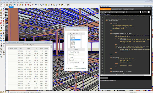
A proprietary plugin for steel modeling and tracking was created to accelerate the use of Building Information Modeling (BIM) at the World Trade Center Transportation Hub. The tool was written to batch convert single line framing plans into 3D steel sizes, using a standard library of parts. This tool was expanded to report steel takeoffs and is now used throughout Turner to support estimating and pre-construction services.
By developing our own tools on top of the intuitive interface of SketchUp Pro, we continue to increase operational efficiencies. The place steel plugin is a great example of how streamlining the modeling process by reviewing the process of modeling steel, standardizing the modeling of stock pieces, and integrating that database information into SketchUp Pro reduces redundancy as well as dimensional errors in steel sizing.
Working with several Turner offices including, New York City and Seattle, a takeoff plugin was developed to support Turner’s current approach to “Control Quantity Models” and “Gross Square Foot” takeoffs. This tool allows SketchUp models to be built for different purposes. For example, using client or business unit standards, we still achieve consistent and accurate takeoffs of square footage, count, length and volumes (using SketchUp Pro’s Solid Tools).
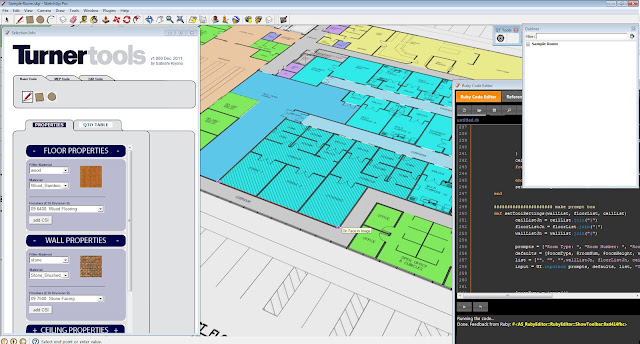
Design information is still in its infancy and rapidly changing. Supporting Turner’s evolving estimating expertise, a plugin was developed to accelerate the takeoff process for conceptual estimates. This plugin allows for rapid creation of space and room plans, as well as the detailed takeoff information that is required for estimates.
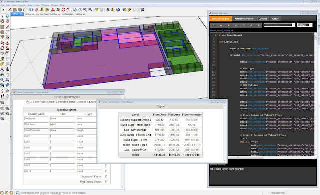
These two takeoff plugins work together to seamlessly streamline the quantity takeoff process developed by estimators in SketchUp Pro. At Turner, we look at opportunities to develop existing processes & workflows using new tools.
In this way, we aren’t teaching new workflows based on new tools as they come along (a very disruptive process for any business). Rather, we’re able to leverage the skill sets and broad knowledge bases of our VDC team to build streamlined versions of existing workflows into new tools.