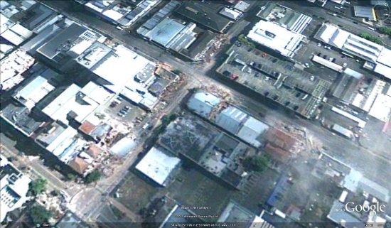
In the wake of the earthquake that struck Christchurch last month, GeoEye captured some fresh imagery of the area and has now made it available to everyone.
While the imagery is a bit cloudy, it really gives a sense of the widespread damage in the area. These images were captured two days after the quake, on February 24.

To view the imagery in Google Earth, they’ve made a few files available for you to download:
• Central and Northern Christchurch![]()
• Southern Christchurch![]()
As Frank mentioned on the Tahina Expedition blog a few days ago you’re encouraged to contribute to the families affected by the quake on the Christchurch Earthquake Appeal site.
(Via National Business Review)