Google Earth: Le Tour de France

The 2011 Tour de France has recently gotten underway, and Cycling the Alps has built some fun tools to help you see the conditions that the riders are up against.

We’ve shown you some of their work in the past, such as the great games that they added to the site earlier this year. Now they’ve combined that technology with the Tour de France and the result is quite cool.
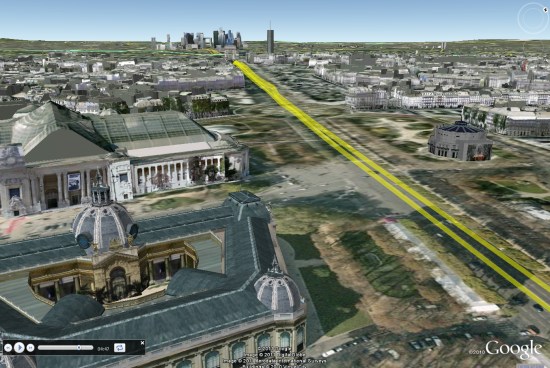
paris.jpg

They’ve gone through and created 3D tours, Streetview tours, profiles and games for every leg of the race. It’s quite an impressive list. Here are a few of the highlights to look for:

Stage 8

There are two stages in the Massif Central which are going to be very challenging, including the last two climbs in this stage: Col de la croix Saint Robert and Super-Besse Sancy.

Stage 12

In the Pyrenees and the climbs of this stage are epic. The Tourmalet is the most famous one but Luz-Ardiden gets a lot of attention in the media as well.

Stage 14

Stage 14 in the Pyrenees is probably the most difficult stage in the race, with six significant climbs.

Stage 18

This years tour is celebrating 100 years of high mountain stages, and every race featured a climb of the Col du Galibier. This year they’ll be climbing the pass two times; once from each side. In stage 18 they will even finish on the Galibier. This is the highest stage finish in the history of the Tour de France.

Stage 19

The next day they will climb the Col du Galibier from the other side, and all three climbs on the 19th stage are legendary.

There’s an amazing amount of info on this site about the Tour, and the games make it fun to ride around on each stage. Congrats to the CTA team for putting this all together.

Google Earth: a window to greater learning


We love hearing stories about how people all over the world use Google Earth. Richard Allaway, a teacher at the International School of Geneva – Campus des Nations, recently shared his thoughts on the importance of Google Earth in his classroom. With Google Earth, Richard is able to create a unique experience in which he and his students can travel the world, exploring everywhere from the bottom of the Atlantic Ocean to the peaks of the Smoky Mountains. We loved his story so much, we want to share it with you too!

Here’s what Richard had to say:

There are two windows in my classroom. One window looks past the buildings of the International Labour Organization, Geneva’s Jet d’Eau, and onwards to the Alps.

Google Earth’s representation of the view from Richard’s classroom window

Through the other window we can see Mount Etna, the meanders of the Mississippi, all the way to the buildings of Ancient Rome and even significant earthquakes that have happened in the last seven days. This “other” window is Google Earth.

I am a humanities teacher at the International School of Geneva – Campus des Nations working with students ages 11 to 18 years old. But Google Earth is an important tool in any teacher’s toolbox because it provides a free and accessible gateway to far-off places. I use Google Earth to enhance my students’ learning opportunities and help them better understand the places we discuss. From our classroom, we can visit the landscapes that we can’t normally see through the limited viewpoint of a real window.

For example, we’ve taken a tour through the limestone landscapes of the Yorkshire Dales in the United Kingdom. Guided by a Google Earth tour and supporting worksheet, my students explored the unique limestone features and saw for themselves how geological processes shape our environments.

To study the possible eruption of Mount Rainier in the American northwest, we used Google Earth to visualize the hazards and the corresponding management strategies. Students were then challenged to use Google Earth or Maps to plan an escape route for what is considered to be a low-probability, but high-consequence event.

Information in Google Earth about Mount Rainier

GeographyAllTheWay.com is the website I use to organize and deliver my teaching resources. Students can access it from any location, whether they’re at the library, at home, on their computers and on their smart phones. It’s a continually developing project, but also a service that I welcome my fellow educators to use to help support their own lesson planning.

We love hearing inspirational stories like Richard’s, so if you want to share a cool experience you’ve had using Google Earth, tell us – we’re listening!

Posted by Vaishaly Shah, Google Earth Team