The Amazonian Street View

With Google Street View, you can do amazing things such as hike around Stonehenge or even ski down Whistler’s slopes—all without leaving home. Soon, you’ll be able to float down the Amazon and Rio Negro Rivers of northwest Brazil and experience some of the most remote and biodiverse areas in the world.

A few members of our Brazil and U.S. Street View and Google Earth Outreach teams are currently in the Amazon rainforest using our Street View technology to capture images of the river, surrounding forests and adjacent river communities. In partnership with the Foundation for a Sustainable Amazon (FAS), the local non-profit conservation organization that invited us to the area, we’re training some of FAS’s representatives on the imagery collection process and leaving some of our equipment behind for them to continue the work. By teaching locals how to operate these tools, they can continue sharing their points of view, culture and ways of life with audiences across the globe.

We’ll pedal the Street View trike along the narrow dirt paths of the Amazon villages and maneuver it up close to where civilization meets the rainforest. We’ll also mount it onto a boat to take photographs as the boat floats down the river. The tripod—which is the same system we use to capture imagery of business interiors—will also be used to give you a sense of what it’s like to live and work in places such as an Amazonian community center and school.

Image of the Tumbira community in the Rio Negro Sustainable Development Reserve
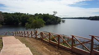
In this first phase of the project, the Google and FAS teams will visit and capture imagery from a 50km section of the Rio Negro River, extending from the Tumbira community near Manaus—the capital of the state of Amazonas—to the Terra Preta community. We’ll then process the imagery of the river and the communities as usual, stitching the still photos into 360-degree panoramics.

Image of the Tumbira Community

For many outdoor enthusiasts, travelers and environmentalists, this creates an opportunity to experience the wonders of the Amazon, which will be accessible in a way they’d previously only dreamed about. We’re honored to work with FAS on this project to bring the Amazon online for those who can’t visit in person, and help our partners share with the world the unique stories of its inhabitants and the beauty of this place they call home. 

Journey in Google Earth

Last year, Laura Hillenbrand released a book titled “Unbroken: A World War II Story of Survival, Resilience, and Redemption“, based on the life of Louis Zamperini (details on Amazon). The book has been very popular, quickly becoming a best-seller and recently being picked up by Universal Studios to be turned into a movie.

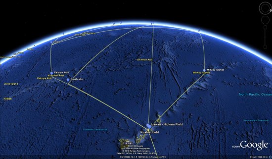
The life of Zamperini is amazing, and the book is excellent. Zamperini, a world-class runner that competed in the Berlin Olympics in 1936, is drafted into World War II. He fights a number of missions before his plane goes down and he’s trapped in a raft at sea. After 46 days at sea, he floats into the Japanese-controlled Marshall Islands, and he’s placed in various POW camps for the next few years.

In reading the book about his journey, I realized that it would pretty cool to track down his various missions and POW camps in Google Earth. I was right! However, I was unable to find a decent timeline of his life, so I spent a few hours researching it and created one myself. After that, I did more research to find all of those locations in Google Earth and ended up with a pretty cool file.

zamp-hawaii.jpg

The file includes locations from his early days (homes, school), the various places he went for military training, the Pacific missions he completed, the POW camps he was placed in, and the various stops on his journey home. You can download the KMZ file here to try it for yourself.

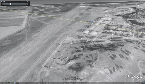
I had hoped that historical imagery might come into play with this, but the old imagery in the Pacific and Japan doesn’t go back nearly far enough (as opposed to Europe, where many locations have historical imagery dating back to the mid-1940’s). However, one good example was Hamilton Field, where he stopped over on his way to Hawaii. The present-day imagery no longer shows a runway, but if you switch to the 1993 imagery you can clearly see the runway still there.

hamilton-field.jpg

All of that being said, I’m sure the file isn’t perfect. If you make any corrections to it, please email me the updated version (mickey@gearthblog.com) and I’ll update this post.