We’ve seen a lot of interesting real-time data feeds into Google Earth over the years, the most common being real-time air traffic and a feed of real-time satellite locations.
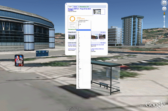
A new set of models from iNovmapping brings it to a different level — stationary objects with real-time data inside. For now, their demonstrations are for bus information, found by clicking on a bus stop, and recycling information, found by clicking on a recycling container. Here are a few screenshots and KMZ files to show you what we’re talking about.
Bus Stop – KMZ
Recycling Container – KMZ
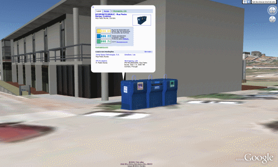
What makes these very unique is that the KMZ files aren’t necessary to make them function — they’re just to help you locate the models. In every other real-time product we’ve seen in the past, it’s been managed via a network link. In this case, they’ve added an iframe to the description box on the 3D model itself, and then they can update the information inside of the iframe with up-to-date data about that location. You don’t need to load any external KML files or network links; you can just use the standard “3D Buildings” layer in Google Earth.
If I’m not mistaken, this is the first time we’ve ever seen something like this and the potential for it is huge!
• Find a house on the beach, click it to get real-time rental prices.
• Click on a restaurant to get operating hours for today.
• Click on a house for sale to get info about pricing, open houses, etc.
• Click on a conference center to see what events are happening inside today.
The possibilities are endless, though most of the business ideas mentioned above don’t have 3D models yet. Those that do would then need to find a way to keep the iframed page updated daily, which could be technically challenging and/or time consuming. While there are some issues to work out, this is still quite impressive.
iNovmapping wants to take it even further, though. Some ideas they have for the future:
For example, developers could incorporate feeds of shows in Theaters or of expositions in Museums. This would turn the 3D layer more useful and would create an incentive on the part of the real-estate owners to put their buildings on the GE 3D Layer. Another feature … is the possibility of clicking buildings on the Earth Layer of Google Maps. Everyone likes to see realistic models but we appreciate it evan more if they speak back at us.
They make some great points. While Google Earth is an amazing tool, it’s historically been quite anti-social. Any social games or social apps of any kind end up using the plug-in via the browser, rather than try to do it inside of Google Earth. I tried making a discussion forum inside of Google Earth a few years ago, but it was quite clunky. If (when?) Google ever moves “My Places” into the cloud, that could help with sharing, but until then it’s very limited. It’s great to see a company like iNovmapping try to push the envelope a little bit with methods like this.

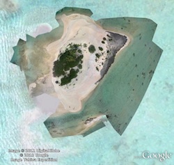 When Google updated its
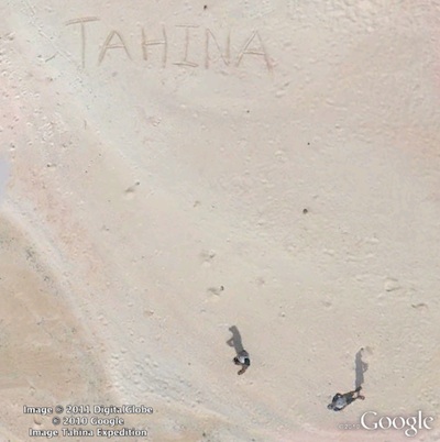
 , you can see the rest of the motu in ultra high resolution (much higher than most Google Earth imagery, you can even zoom in further than seen above). Or try