The Bing Maps Windows Presentation Foundation Control v1

Back in August, was announced the Beta for our Bing Maps WPF control. The uptake in the Microsoft Developer Community has been stellar and the feedback – immensely helpful. As a result and as promised to those across the Microsoft Developer Network, we’re officially releasing The Bing Maps Windows Presentation Foundation Control, Version 1.

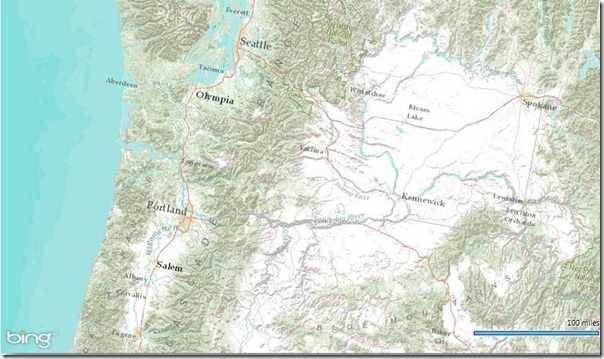
Bing Maps WPF Control with an ESRI Topographic Map Tile Overlay

The control was built atop of the beta, so we still have all of the touch enabled greatness for Surface v 2’s Pixel Sense, inertia and full rotation. We’ve kept most of the classes, methods and properties in place from the beta – requiring little work to install and register v1. And, per community feedback on the Bing Maps MSDN Forums we added the following features (and fixed a few bugs):

  1. Support for tile layers – you can now overlay your own tile layers atop the map control.
  2. Turning off the base tile layer – this is useful for when you don’t need/want to use our base map tiles and instead would prefer to use your own without overlaying them atop of ours. The control won’t request the tiles which reduces downloads and improves rendering performance.
  3. SSL Support – since many of you are using the WPF control in secure applications, you can now make tile and service request over SSL without issue.
  4. Hiding the scale bar – if you don’t want a scale bar (perhaps your map is small and the scale bar clutters the map) you can turn it off. In fact, the only elements you can’t turn off are the Bing logo and the copyrights.
  5. New copyright service – provides accurate copyright for our data vendors.
  6. Additional inertia – inertia is now enabled for the mouse and is on by default for touch.
  7. Miscellaneous bug fixes – thanks for the feedback on the MSDN Forums, the Bing Maps Blog, e-mail and Twitter. Good finds people.

I have to give it up for my (small) crack team of people involved in the making of the WPF Control. This was one of those 10% projects that we all really had a passion to get done because it was the right thing to do for the Microsoft Developer Community. So, we found the time, slipped the release a month (for quality) and, as the guys over in Surface said, “just got it done.” Our internal motto kept stoking the fire to push this bad boy out the door…”WPF, FTW!”

Now, download the Bing Maps WPF Control, build a killer app and make us proud.
New 21 cities with 45° imagery

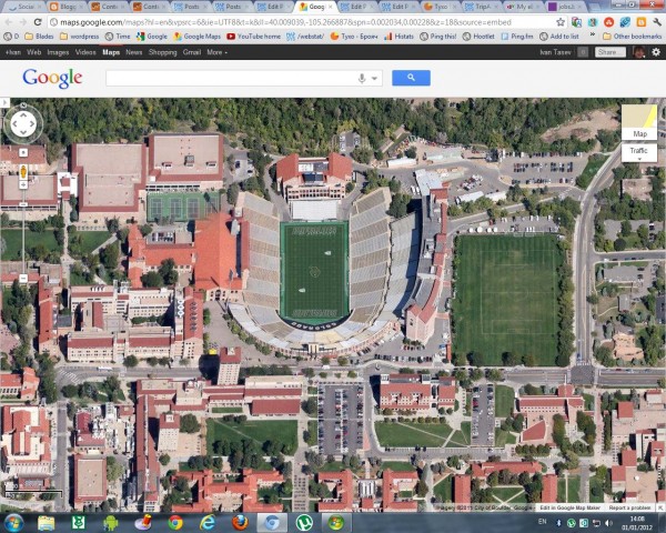
Viewing 45° imagery can make the map much more fun and informative by enabling you to see a tilted aerial perspective of some of your favorite spots. In this month’s 45° imagery update in Google Maps, I highlight one of my favorite towns in Colorado.

Boulder, Colorado is a mecca for outdoor hiking, cycling, and climbing excursions and 45° imagery can help users plan their adventures. Located at the base of the Rocky Mountains, Boulder is at an elevation of 5,430 feet (1,655m) above sea level which makes for fun terrain to look at from a bird’s eye view. Here’s an image of Folsom Stadium at the University of Colorado, Boulder:


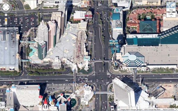
The “Strip” in Las Vegas, Nevada is also included in the latest batch of 45° imagery. Now you can see the some of the large casinos and resorts that dot the famous Las Vegas Boulevard.

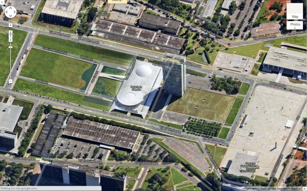
Next we head to the southern hemisphere to Brasilia, the capital of Brazil. The city sits high up on a plateau and some say the aerial view of Brasilia resembles an airplane. Now you can fly even closer and get a 45° look.

Here is a list of updated cities:

U.S.
Albuquerque (west), NM; Benton, AR; Boulder, CO; Eldridge, IA; Boston (east), MA; Centennial (south), CO; GooglePlex, CA; Indianapolis (south), IN; Las Vegas Strip, NV; Montgomery (outskirts), AL; Olathe, KA; Petaluma, CA; Tulsa, OK

South America
Brasilia, Brazil

The Airport Maps for Bing

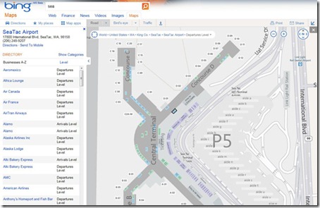
Bing announced detailed airport maps as the newest addition to our popular venue maps for Bing Maps. The new airport maps give you everything you need to navigate your way through your travels. Airport maps include information on parking garages, ticket counter location, terminals and gates, baggage claims, currency exchange and more! You’ll also see a sortable directory of airlines, cafes and restaurants.

Finding Airport Maps

They’ve made locating airport maps an easy task from your desktop. There are two ways to do this:

1. Just search for the airport (by name, city, or even code) on Bing Maps, and zoom in using map.

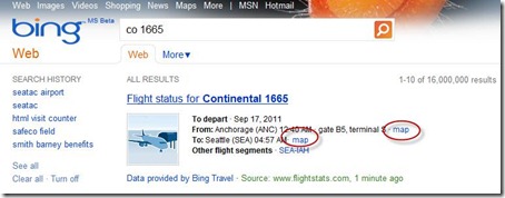
2. Search for your flight status on Bing (for example: CO 1665), and click on the map link besides the airport to see its map.

airportmaps3_v02

Airport Maps from your desktop

airportmaps_4

Airport Maps on Bing’s Flight Status

You can also view different levels within your selected venue by clicking the “Level” button at the top of the screen and then selecting the correct level from the provided list.