New Maps domains in 11 countries in Middle East & North Africa

With the growing numbers of Internet users in the region, we noticed that a huge number of search queries have a geographic component. So, we’ve been working on providing rich, local geographic data to offer you the best local experience possible and today we are announcing the launch of local Google Maps domains for 11 countries across the region.

Now, Google Maps will be easily accessible from your local search domain in Algeria, Libya, Egypt, Lebanon, Jordan, Kuwait, Bahrain, Qatar, UAE, Oman, and Saudi Arabia. You’ll also be able to use it in Arabic as well as English and French for some countries. You can use Google Maps to search for a city, navigate your way around towns, or find a local business. This could be a Falafel place in Amman, a hotel in Cairo, or a restaurant in Jeddah.

Having access to maps on your local domain is more than just finding your way from A to B. There are many ways that businesses and individuals can contribute to making Google Maps in your country more useful and more accurate. Check out some of the following features:

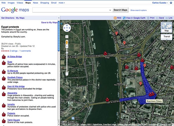
Use My Maps to create your own personalized maps, for example a customized map of your favourite places in your neighborhood to share your experiences with others.

Maps in Algeria, Libya, Kuwait, Bahrain and Qatar have been made possible in large part by passionate users mapping their countries via Google Map Maker, which is available across the world in more than 180 countries and regions. Map Maker allows you to use your local knowledge to practically edit the entire map – from roads, businesses, parks, schools and more. Users have mapped out entire countries or just made their neighborhoods look stunning. Starting today Google Map Maker is now launched in Saudi Arabia and the United Arab Emirates.

It is also possible to include a Google map on your own website. You can display information – like a restaurant location or directions – on a Google map and embed it in your website using our Google Maps API. There are many great sites already using the API to share customized information on Google maps. For the developers and webmasters amongst you, the possibilities are endless.

Great User Created Maps Chronicling Egypt

During the crisis in Egypt, third-party Geo developers helped the international community understand the situation and keep persons affected by the crisis safe through the use of innovative new tools. These same tools can be replicated by anyone in any crisis situation. In the developer examples below, three things jump out as particularly striking: How quickly these maps were built and put into action, some within hours of the first protests; how developers (many contributing independently) from all over the world worked together to get these maps up and running; and how geo-context has become extremely important for the international community in understanding and responding to any crisis, be it natural or man-made.

NY Times – Mapping the Protest in Cairo Day by Day

In this map, the New York Times has plotted the locations of the protests and clashes with police. There are also pictures, videos and contextual information provided in the icon info bubbles.

Al Jazeera – Mapping the Day of Wrath

This website features a video illustrating the geographic spread of the protests using fly-over animations in Google Earth. The same webpage includes maps with information about protests in Cairo and throughout Egypt.

Hypercities Egypt

Twitter’s real-time updates have become an invaluable tool for the Egyptian protest organizers, observers and citizens looking to stay safe. Hypercities Egypt used Google Maps to display geolocated tweets as they came streaming in. Also, view another Egypt Twitter map created by MiBazaar.

GeoEye Tahrir Square Imagery

The imagery above is of Tahrir Square on January 29, 2011 at around 10:30am local time from more than 400 miles above. This imagery is exclusively viewable in Google Earth (and the Earth API) using the historical imagery tool. The imagery highlights GeoEye’s stunning ability to respond to world events and capture timely imagery.

Egypt Protests in Google My Maps by Storyful.com

During the crisis, many Geo developers and persons without a Geo developer background collaborated on Google My Maps to chronicle the events geographically as they unfolded, such as this one by Storyful. Using the My Maps tool, anyone with access to Google Maps could create a collaborative mash-up with custom icons, colored polygons, content rich info-bubbles and many other features. Once completed, the map can be shared globally through My Maps or embedded on a website. Access can also be restricted to a select group of people if need be. Learn more at http://maps.google.com/getmaps.

———–

How you can help: During a crisis situation, up-to-date maps are often crucial for organizing humanitarian aid and effective response. In many regions, however, accurate and local map data is sparse, out of date, or not available at all. You can add your geographic knowledge to Google Maps by contributing map edits in Google Map Maker, which is currently available in select countries and territories.

Saudi Arabian developers and entrepreneurs, are you ready?

“I was living in a dark room full of stuff and Google turned the lights on for me”, one participant said. Some 97% of those who attended G-days last year in Cairo, Egypt and Amman, Jordan expressed similar sentiments.

Building on this success, Google will host another G-day event in Saudi Arabia, dubbed “G-Saudi Arabia“, which will take place on March 19th and 20th. Google engineers will be on hand to give lectures and meet informally. The first day will be dedicated to academics and developers, both novice and advanced ; the second day targets entrepreneurs and professionals who want to learn about AdWords, Google Apps and other projects. Since space is limited, please apply now.

Since holding G-Egypt and G-Jordan, we’ve analyzed the feedback from participants to improve the upcoming events. We received more than 3,000 comments. Here is a representative sampling:

  • Content: “I learned a great about what Google does and I left with a great admiration to this Google. I admire their interest in Egypt and the region and I see Google as a being a catalyst for many things to happen in this region. The Google culture, positive approach, and excitement about innovation is infectious.”
  • Googlers & interaction with them: “The best thing I enjoyed was actually talking and chatting with the Googlers, in between sessions and asking them questions. Everyone was extremely helpful and doing their best to answer my questions.”
  • Organisation: “The event was awesome… I cannot believe that I attended an event like that in Egypt.”
  • Atmosphere & chill-out zones: “Giving the spirit of Google, I felt as I’m at Google headquarters.”
  • Choice of venue & food: “the Google cupcakes were amazing!”
  • Coding competition: “I think the best part by far, for me, was the coding competition.”
  • Time management: “Speeches were running and ending on time”

The negative feedback also were appreciated. Some said we need to slow up coding sessions and give more concrete examples. Some want additional technical content. Others suggested separating beginners from advanced developers. And others asked for longer breaks to mingle. We’ll put these suggestions into the upcoming G-Saudi Arabia agenda.

In order to encourage Saudis to participate, take a look at a selection of the pictures from our Egyptian and Jordanian events. Keep sending the comments and above all keep sending any cool applications you develop on Google technologies. We look forward to resuming our dialogue with Arab developers and entrepreneurs.