Google Map Maker & Chicago

(Cross-posted from the Student Blog)

The Google Map Maker campus tour recently visited the Windy City to talk to students about how they can use Map Maker to map their campuses and make updates to places they care about on Google Maps. While in town, we also hosted a Map Maker event at the Google Chicago office to share the tool with folks working in the public sector. We had a great time meeting so many enthusiastic mappers from the area, and look forward to seeing how they put Chicago on the map.

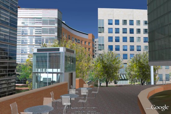
Our first stop was the University of Chicago campus, a beautifully historic area with architectural gems galore. Students who attended this event were excited to map not only their campus, but neighborhoods near the university, showing the diversity and development of the population and culture.

Our second stop was Northwestern University, where a packed room of students learned about mapping while sampling some traditional Chicago style deep dish pizza. Delicious! Students were particularly interested in adding details to their campus, naming the buildings, adding locations of the sororities and fraternities, and marking the building outlines or footprints of their favorite restaurants and stores nearby.


Our Google Map Maker team loved partnering with Google Student Ambassadors from these campuses, who creatively and passionately helped plan these events. You guys did an amazing job! The Google Student Ambassadors from Northwestern University had this to say about the Map Maker visit:

“Our event brought together over 120 Northwestern students who were eager and excited to learn about how they could make an impact by adding to Google Maps using Map Maker … Map Maker was a welcome product that put the power to shape the map in our hands. All in all, it was an incredibly fun and engaging experience!”

-Sourya and Minjae, Google Student Ambassadors at Northwestern University

The last event—a meeting with public sector officials at the Google office in Chicago—gave us some great insights about how Map Maker can be used for large metropolitan areas. University educators, Department of Transportation employees, Census Bureau representatives, Chicago Health Department folks, and many more shared how they would like to see Map Maker applied to what they do. We really appreciate all their feedback and suggestions, as well as their enthusiasm for how this tool can help them share their work with each other and the public.

Chicago and the surrounding areas were such enjoyable places to visit, full of vibrant and passionate people. We look forward to visiting other campuses in the fall, but don’t wait until then to leave your mark on your campus!

Google Map Maker: Map the Midwest

During one of the Map Maker Community team’s recent college campus events in Chicago, we had the pleasure of meeting Phil Swanson, an international studies and business student, who travelled nearly 200 miles to join our mapping event at the University of Chicago.

As soon as we started talking with Phil, his passion for mapping and computers came shining through, so we were excited to learn more about what drives him to add to, edit, and create using Google Map Maker.
According to Phil, it all started with retrofitting an interactive campus map when he was a web developer at the University of Wisconsin, Platteville. There was an existing version that utilized the Google Maps API, which he further developed, resulting in this useful campus map. Phil says about the project, “I love to make simple things for people to use, and I’ve always been interested in maps, so that project definitely created an interest in maps and mapping in general.”


Once Phil realized the positive impact his mapping could have on the university, he continued using Google Map Maker to ensure all of the campus details were correct. He began seeing his edits appear not only in Google Maps, but also on Google Maps for mobile on his phone when he searched maps near the university. “Seeing edits transition from Map Maker to Google Maps on mobile and filling in the details make maps that much more useful for me and the world,” Phil said about mapping his town and the campus.


What aspect of the maps does Phil enjoy most? “I love mapping buildings. Seeing the buildings from my University show up on my phone is the best.” Phil has developed a handy system of finding what needs to be fixed on the map, going out with his phone to take pictures, then adding those photos to a web album which he can then include with his edits in Map Maker. “This is especially useful for buildings . . . . It might sound obvious, but I find that my edits are much more likely to get approved if I describe what I’m doing and link to a photo for a more complex edit.” What a helpful technique to use during the review process!

We want to thank Phil for taking the time to hang out with us in Chicago, and also for sharing with us what excites him about mapping. We look forward to seeing more great mapping from Phil, and hope other students are inspired to make the maps of their own colleges and universities more comprehensive and detailed!

For more useful tips like Phil’s, visit the Map Your World Community forum to see what others are doing.

3D Virtual Campus at Northeastern University

We’ve seen a variety of 3D College Campuses over the last few years, such as the awesome 3D buildings at Bowling Green and the collection of tools at the University of Exeter.

We’ve also shown you Northeastern University in the past, when they added 88 3D buildings to their campus. Now they’ve done a few more things that are quick exceptional.

The main piece they’ve added is expansion of their campus map to highlight its “global learning experiences” in 160 cities across 60 countries, and also to show incoming students the cities across the globe where international students are from.

They’ve also added a lot more detail to the campus, including 3D trees (unrelated to the new 3D trees in Google Earth 6), and even some tables and chairs. It looks amazing!

northeastern.jpg

For more, go check out the new and improved campus map, fly to the campus in Google Earth using this KML file or read the details in their press release below:

Current and future Northeastern University students are experiencing the Boston campus, global study opportunities and the school’s rich cultural diversity in a whole new way with CampusBird, the first interactive campus map using 3D and other dynamic media.

CampusBird™, developed by Boulder, Colo.-based concept3D, presents a virtual mapping environment and content management system, based in large part on Google Earth and Google Maps, for prospective students and other visitors to explore.

Northeastern University is making the most of concept3D’s technology in several innovative ways. The Northeastern 3D campus guide and global links are at: northeastern.edu/neuhome/aboutnortheastern/maps.html.

In addition to Northeastern’s 3D virtual tour of its urban Boston campus, students also can “fly” across the Google Earth world and click to read about global learning experiences NU offers in 160 cities in 69 countries. Incoming students also can click to see the cities where international students are from in 125 countries.

By clicking on Costa Rica, for example, both students and their parents can learn how NU is partnering with the Children’s Hospital there, or zoom into England where Northeastern students works with leading companies like Barclays Wealth and One change: Turner Entertainment Network should be Turner Broadcasting Systems, Cartoon Network Europe.

“Presenting the university’s global presence and its cultural diversity along with the 3D tour throughout its Boston campus allows for a completely immersive online experience,” said Oliver Davis, concept3D CEO and co-founder.

“As Northeastern continues to expand its global presence, we seek more innovative ways to inform prospective and incoming first year students of Northeastern’s extensive worldwide network and educational reach beyond Boston,” said Philomena Mantella, Senior Vice President, Enrollment & Student Life at Northeastern University. “A key advantage of this map is its capability to showcase the locations across the globe where our students are making an impact, whether it’s through our global co-op program or various academic programs.”

University officials also are planning to launch a series of guided themed audio tours before the new year.

To create a CampusBird 3D map, concept3D’s team of globally recognized 3D modelers and web developers build photorealistic 3D models of campus buildings and grounds and place them in Google Earth. Layers of information are added to the CampusBird platform to provide location-based details such as individual building info, parking and Wi-Fi hotspots.

The process, which takes anywhere from four to 12 weeks, produces a detailed virtual environment that current and future students, campus visitors, university staff, alumni and community members will find both useful and fun.

Using Northeastern’s 3D map, for example, a student can move around a building or jump clear across campus, seeing different views of the university and Boston skyline. Click on each building for a color photo, short description and further location details. Admissions prospects have a 3D view of the place they’re thinking about their next four to five years.

Each CampusBird interactive map is easily added and updated by school staff through the CampusBird online content management system hosted by concept3D. The CampusBird CMS allows schools to simply and dynamically update, edit and add content to their map. If an image, video or description is changed in the CMS, the map is automatically updated on the school site and campusbird.com.

The interactive map and 3D models become permanent assets to the institution, and are often used by campus planners, architects and engineers, development staff and safety personnel. Universities also are repurposing concept3D campus maps in video format for more visual recruitment and capital fund-raising efforts.

“Our clients find so many ways to use the 3D content and maps that they often achieve ROI/payback in as little as three months,” Davis said.

Along with the institution’s own website, college.campusbird.com and the CampusBird iPhone app, the models and maps appear on Google Earth, Google Maps and other websites that use Google Earth browser tools.