SketchUp World in 3D


A new website called Your World in 3D to help introduce users to the concept of geo-modeling – the term given to creating 3D buildings for Google Earth and Google Maps. Today, they’re releasing the Your World in 3D website in 15 additional languages: Czech, German, English (UK), Spanish, French, Italian, Japanese, Korean, Dutch, Polish, Brazilian Porteguese, Russian, Turkish, Simplified Chinese and Traditional Chinese.


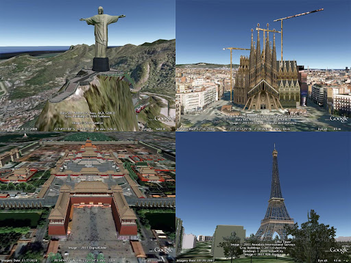
User generated models from around the worldBesides being fun, building your town in 3D is a great way to show civic pride, encourage tourism for your town, and promote your business. 3D modeling has also been used in crisis response situations as we saw in the grassroots modeling effort that happened after the earthquake in L’Aquila, Italy.


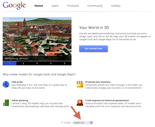
To see the site in another language, use the drop-down menu in the bottom of any pageYour World in 3D has all the tools you’ll need to start geo-modeling and features several examples of what fellow modeling. By releasing Your World in 3D in more languages, we hope that you and your friends from around the globe will join us to help build the most comprehensive 3D virtual mirror of planet Earth.

GoogleSketchUpBlog

Reykjavík Center Map


Reykjavík Center Map

One of the more unique interactive city maps I have seen to date is the Reykjavík Center Map, an online map of Iceland’s capital. Yes, it’s a pushpin map, but it uses an isometric projection (which I’ve seen in some Chinese maps) and the base map is a veritable work of art — it’s not at all computer generated, and it looks like a watercolour. Snorri Þór Tryggvason, who worked on the map with some friends and sent me the link, wrote, “The mapmaking took two years and over 3,000 hours to complete,” and I believe him.

China targets illegal maps

Yes, it is not a mistake. Maps can be “illegal”. That is, only in countries that have in place a licensing regime – such as China. The aim is to remove from the web maps that have “political mistakes” (I presume it refers mainly to representation of borders and “territories”) and those that disclose State secrets (I remember this rule from the old communist country of my origin, where city maps had big holes where the industrial zones were located). Well, that’s one way to achieve consistency in mapping data across the whole country, just hope no one will have similar ideas in Australia!

What’s really interesting, are statistics quoted by the Chinese State Bureau of Surveying and Mapping: it “…uncovered 1,058 cases of illegal mapping services, including more than 30 relating to foreign organisations and military”, “…3,686 websites out of 41,670 web mapping service websites were found to contain political mistakes, and more than 200 websites were closed”. Mapping must be quite popular there, but that’s China. I wonder what would be the numbers for Australia (total websites of course, not closures!).

On a related topic, Chinese government is not the only one censoring online content. Google created this interesting map that shows world wide statistics about “Government requests directed to Google and YouTube” to remove content from services, or provide information about users of services and products.