Nokia Maps WebGL (Beta)

Nokia Maps WebGL (Beta)
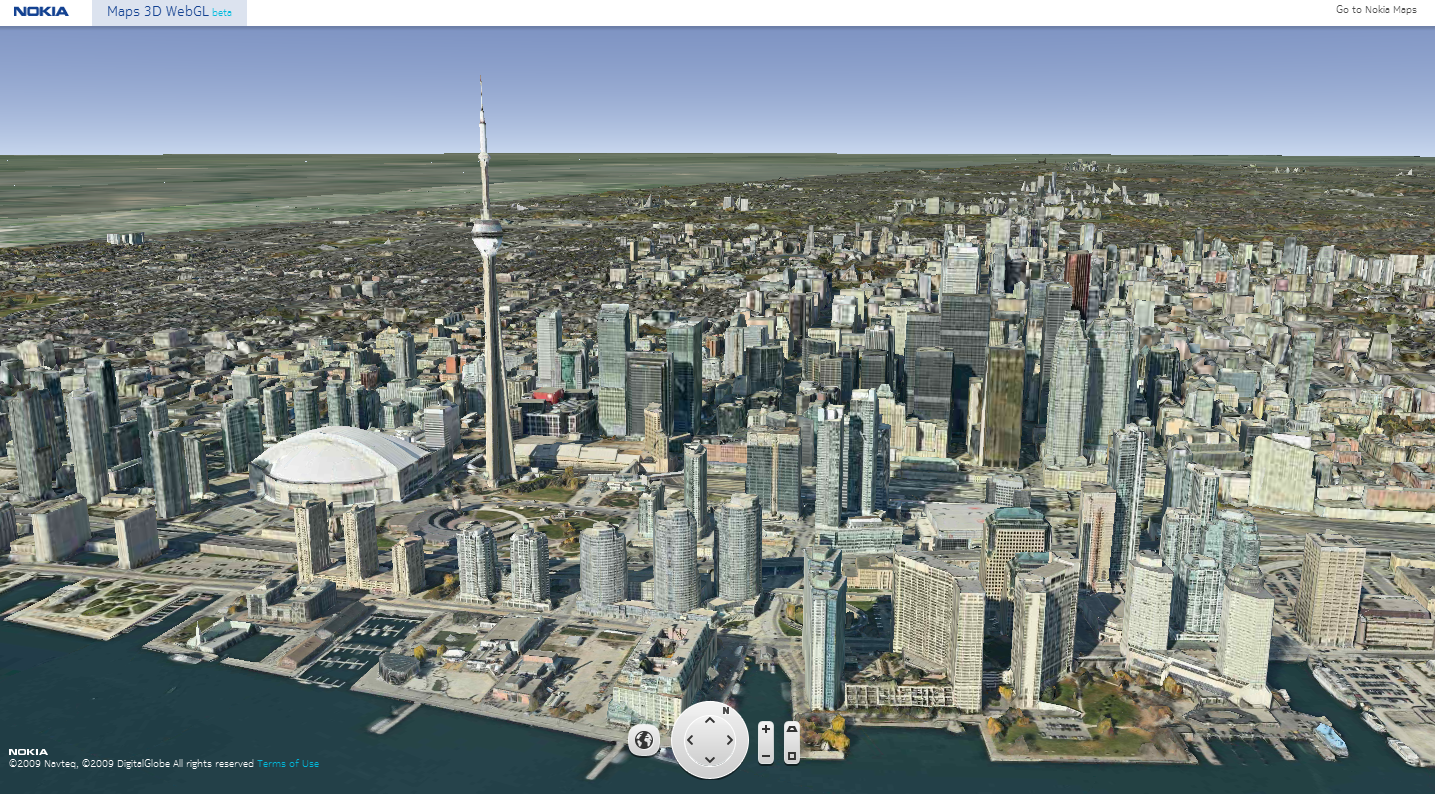
Nokia Maps WebGL – Toronto, Canada
Using Google Chrome Nokia Maps WebGL is extremely smooth and fast rendering 3D Buildings with photo-realistic quality, on par with Google Earth Desktop
WebGL (Web-based Graphics Library) is software hat extends the capability of the Javascript programming language to allow it to generate interactive 3d Graphics within any compatible Web Browser. WebGL code executes on a computer Graphics card’s(GPU), which supports shade rendering.
To try this – use the latest version of Google Chrome.
Nokia Maps WebGL:

The Airport Maps for Bing

Bing announced detailed airport maps as the newest addition to our popular venue maps for Bing Maps. The new airport maps give you everything you need to navigate your way through your travels. Airport maps include information on parking garages, ticket counter location, terminals and gates, baggage claims, currency exchange and more! You’ll also see a sortable directory of airlines, cafes and restaurants.

Finding Airport Maps

They’ve made locating airport maps an easy task from your desktop. There are two ways to do this:

1. Just search for the airport (by name, city, or even code) on Bing Maps, and zoom in using map.

2. Search for your flight status on Bing (for example: CO 1665), and click on the map link besides the airport to see its map.

airportmaps3_v02

Airport Maps from your desktop

airportmaps_4

Airport Maps on Bing’s Flight Status

You can also view different levels within your selected venue by clicking the “Level” button at the top of the screen and then selecting the correct level from the provided list.

OSM to Google Earth

BBOX.ME (OSM to Google Earth) via FME

BBOX.ME (OSM to Google Earth) via FME
Left toolbar highlight large data download – red (large) amber medium and green is small data.
(OSM Servers will restrict large downloads automatically)

Take OpenStreetMap and via it’s API, users can download an area of interest.

in this case:

“http:\api.openstreetmap.orgapi�.6map?bbox=-0.4994028225856829,53.73689294256218,-0.4839962145221512,53.74135397370099”

is requested from the OSM server via the OSM API.

OSM FME Workbench
FME Workbench for converting to Google (or 3D PDF etc)
BBOX.ME OSM to Google Earth
Output is A clean representation of OSM in Google Earth – but with 3D Building Extruded from the data. This can also be viewed in Streetview in Google Earth.

Extruded 3D Building (from Open Street Map) overlaid in Streetview in Google Earth
Extruded 3D Building (from Open Street Map) overlaid in Streetview in Google Earth.

This does use FME Desktop (a 30 day trail is available) which can convert the OSM files into Google Earth

Try BBOX.ME (created and founded by Peter Segersted and Ulf Mansson)
http://bbox.me/osm/