3D tour of the Costa Concordia


Peter Olsen (who just days ago unveiled the excellent Terra Nova models) has built an incredible 3D tour of the wreck, with the entire journey animated!


costa.png 

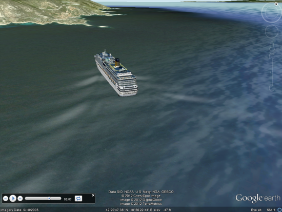
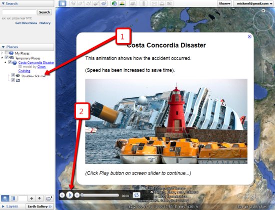
The speed has been increased to save time, so you don’t have to wait 2-1/2 hours for it to finish, but it’s otherwise as accurate as possible. To see it for yourself, simply visit the Costa Concordia Disaster Animation page in the Google 3D Warehouse and choose the “View in Google Earth” link.

If you’re not familiar with using Tour files in Google Earth, simply click the “Double-click me!” text on the left to get it started, then click the play button at the bottom to step through the introductory slides, as seen here:


tour.jpg 

Fully animated tours like this are a great way to recreate events, and Peter is one of the best around at creating them.

via: GoogleEarthBlog

The Thailand Floods


As Google often does during disasters (such as the Gulf Oil Spill and the Japan Earthquake, Google has set up a Crisis Response page to help provide information for those trying to assist with the flooding in Thailand.

The flooding has become quite devastating and more widespread than most people realize. From Google’s page:

Thailand is currently facing its worst flooding in 50 years. Flood waters have swamped more than two-thirds of the country, submerging rice fields and shutting down hundreds of factories while over 900,000 families and businesses have been impacted and hundreds of lives have been tragically lost. National relief efforts are now focused on providing essential food, clean water and shelter to displaced people and restoring damaged infrastructure to the Kingdom of Smiles.

You can use the map on their page, or download various elements as KML files to be able to browse them in Google Earth. For example, here is the “Flood affected areas across Thailand” map (KML
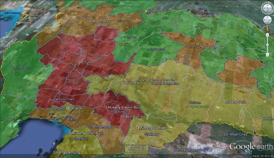
), which gives you a quick glance at the hardest hit areas.


flood-affected.jpg 

For fresh satellite imagery of the area, you can use the imagery released by the NASA Earth Observatory a few days ago. You can view the image on their site.


thailandimagery.jpg 

Google Maps Mania