The integration between Google Fusion
Tables and Google
Maps API Premier makes it extremely easy to visualize thousands of
locations on a map. Fusion Tables is a powerful, cloud-based database
with geospatial smarts; you can attach a location to any record and
then execute geospatial queries to find the relevant records.
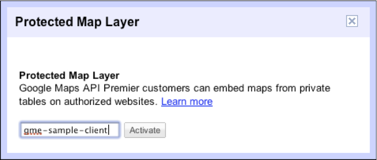
Organizations that need to map sensitive or private data will
appreciate our new Protected
Map Layer. For Maps API Premier customers, simply pop in your client
ID into Fusion Tables and voila, you can visualize your data in
your Maps API Premier implementation (and ONLY your implementation)
and your underlying data tables are kept entirely private.
The marriage of Maps API Premier and Fusion Tables enables a true
cloud-based location platform: no servers to stand up, no database
applications to install – just upload your data and display it on a
map. Dead simple and keeps your data safe – just as it should.