FOSS4G 2011

Look, I’m a realist when it comes to software and philosophy.  Use what gets your work done faster, more efficiently and without killing the penguins down in Antarctica.  I can’t even remember if open source software is “free as in beer” or “free as in I’m a cheap bastard”.  But what I do know is that if you aren’t familiar with all the tools available to you, there is a chance you maybe be doing things inefficiently and probably incorrectly.

That’s why I think this year, a great opportunity for everyone in North America 1 to make time to visit Denver for FOSS4G 2011 next month.  Since FOSS4G was last in our neck of the woods in 2007, the geospatial world has changed a ton.  So many new projects are available and more mature than ever before.  The choice that we all have today is greater than ever before and FOSS4G 2011 will give us all a chance to see what’s new and how we can use these projects in our workflows. 3 days in Denver will give you the information you’ll need to succeed in this space as it rapidly changes. Siting back and letting the world move forward without you is a recipe for obsolescence.

A quick look at the schedule shows that there are tons of great sessions to be involved with and for those who haven’t been exposed to open source projects before, there is a great Introduction to Geospatial Open Source that will help you get a better handle on your options.  I’ll be there all week and so will most of the big geo-personalitites in our space.  They all realize that this is an opportunity that only comes around once ever 5 years (yes it’s been that long since we’ve had one in North America) and you can’t afford to miss out.
How to show and manage organizational data Webcast

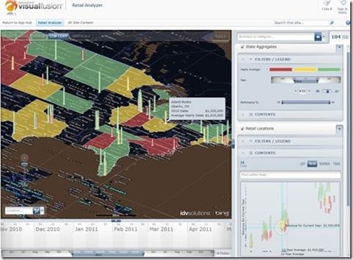
You can join for a webcast that will demonstrate how governments—federal, state, and local—are empowering their constituents with access to organizational data in captivating interactive data visualizations. The webcast will air on Wednesday, June 8, at 1:00 P.M. Eastern Time.

RetailAnalyzerVF5

During the webcast, special attention will be paid to how public sector organizations are turning SharePoint into a geospatial business intelligence engine to gain clearer understanding more quickly, make better decisions faster, and keep their citizens safe. The webcast will offer live demonstrations that show how organizations of all sizes are leveraging the geospatial and time attributes of their data to unite enterprise content, relevant web feeds, mobile device inputs, images, and more into a single view, resulting in speedier decisions, more efficient use of resources, and reduced overall spend.


While everyone is invited to attend, you should definitely attend if you are a:

•    Program manager
•    GIS professional
•    IT professional
•    Anyone looking to make their data available to a wider audience

Presenters:
•    Matthew Pietryszyn, GIS Coordinator, City of Brampton, Ontario
•    Jim Keenan, VP of Government Sales, IDV Solutions

Geospatial Revolution: Episode Four Released

The fourth,  final episode of the Geospatial Revolution project, created by Penn State Public Broadcasting, has been released.

If you’ve missed any of the previous episodes, I strongly recommend that you check them out. Episode One covered a wide overview of “how” and “why” questions regarding geospatial technologies, and Episode Two dug into more specific examples including the City of Portland and the well-known shipping company UPS. Episode Three discussed how geospatial technologies are using in war and in keeping the peace.

Episode Four covers four main topics:

• Monitoring a Changing Climate

• Preventing Hunger

• Tracking Disease

• Mapping Power to the People

As with the previous episodes, you can choose to watch each segment individually or simply watch the full 17 minute video below.

Congratulations to PSPB on creating such an excellent series of videos!