How Google Earth is being used by the Philippine National Police


Over the years, Google Earth has been responsible for helping a huge number of non-profit and other worthwhile organizations around the world. We’ve shown you how environmental groups have been using Google Earth for more than six years, how it’s been used to fight against rainforest logging, and Google Earth Outreach consistenly showcases many other amazing organizations from a variety of countries.

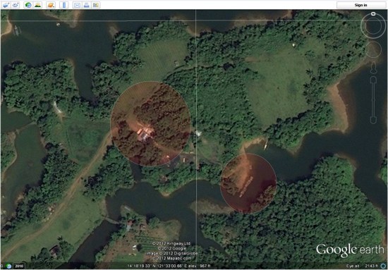
Similarly to the others that have used Google Earth to fight against deforestation, the Philippine National Police have been using Google Earth to fight illegal logging in the province of Laguna.
 

map2.jpg 

Here is their story, in their words:

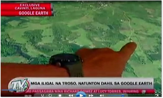
On behalf of all the personnel of Philippine National Police (PNP) Laguna, I would like to express our gratefulness for the wonderful gift of your Google Earth services. It contributed a lot and it has been a great part of our efforts against illegal logging here in the province of Laguna. Nationwide, we are shocked by the effect of the natural and man-made calamities wreaking havoc to our country resulting to loss of lives and properties. Man-made calamities are greatly attributed to rampant illegal logging and deforestation thus causing flash floods and landslides. Since Laguna had been one of the most affected areas of flash floods and landslides, the Laguna PNP initiated the creation of a dedicated Provincial Anti-Illegal Logging Task Group “BERDE” purposely to ensure the implementation of OPLAN “BERDE (Boost Economic Reserves for the Development of Ecosystem). Through the help of Google Earth, we were able to locate specific targets of our OPLAN BERDE. Our operations yielded positive results on illegal logging sites like Cavinti, Laguna that was identified by using Google Earth. Initial operation last April 13, 2012 resulted to the recovery of forest products, machinery equipment, tools and conveyance abandoned during apprehension. Google Earth has been a major contributing factor to the success of our operation. Because of you and your innovative services, we can keep moving forward towards the attainment of our goals in the field of law enforcement.

As Google Earth imagery continues to become higher resolution and update more rapidly, it will become an even more useful tool for organizations like this one.
 

Picture4.jpg 


Building a healthier, greener Google

When it comes to greening our office buildings, we apply the same focus that we use for any of our products: put the user first. We want to create the healthiest work environments possible where Googlers can thrive and innovate. From concept through design, construction and operations, we create buildings that function like living and breathing systems by optimizing access to nature, clean air and daylight.

Since I arrived at Google in 2006, I’ve been part of a team working to create life-sustaining buildings that support the health and productivity of Googlers. We avoid materials that contain volatile organic compounds (VOCs) and other known toxins that may harm human health, so Googlers don’t have to worry about the air they’re breathing or the toxicity of the furniture, carpet or other materials in their workspaces. We also use dual stage air filtration systems to eliminate particulates and remaining VOCs, which further improves indoor air quality.

Since building materials don’t have ingredient labels, we’re pushing the industry to adopt product transparency practices that will lead to real market transformation. In North America, we purchase materials free of the Living Building Challenge Red List Materials and EPA Chemicals of Concern, and through the Pharos Project we ask our suppliers to meet strict transparency requirements.

We also strive to shrink our environmental footprint by investing in the most efficient heating, cooling and lighting systems. Throughout many of our offices, we’ve performed energy and water audits and implemented conservation measures to develop best practices that are applied to our offices worldwide. To the extent possible, we seek out renewable sources for the energy that we do use. One of the earliest projects I worked on at Google involved installing the first solar panels on campus back in 2007. They have the capacity to produce 1.6 megawatts of clean, renewable electricity for us, which supplies about 30 percent of our peak energy use on the buildings they cover.

With a little healthy competition, we’ve gotten Google’s offices around the world involved in greening our operations. Our internal Sustainable Pursuit program allows teams to earn points based on their office’s green performance—whether it’s through green cleaning programs, water efficiency or innovative waste management strategies. We use Google Apps to help us track progress toward our goals—which meet or exceed the U.S. Green Building Council’s LEED standards—and share what we’ve learned among our global facilities teams.

We’re proud of our latest LEED Platinum achievement for the interior renovation of an office building at the Googleplex. While we have other LEED Platinum buildings in our portfolio, it’s a first for our headquarters and a first for the City of Mountain View. The interior renovation was designed by Boora Architects and built by XL Construction, using healthy building materials and practices. In fact, we now have more than 4.5 million square feet of building space around the world on deck to earn LEED Certification.

via Green blog

Better map of Southern Sudan

Sudan is preparing to vote on January 9 to decide if the South will become independent from the North. The referendum is part of the Comprehensive Peace Agreement signed in 2005 ending the Civil War, which lasted 22 years and led to the deaths of an estimated 2 million people. Analysts fear the possibility of renewed violence.

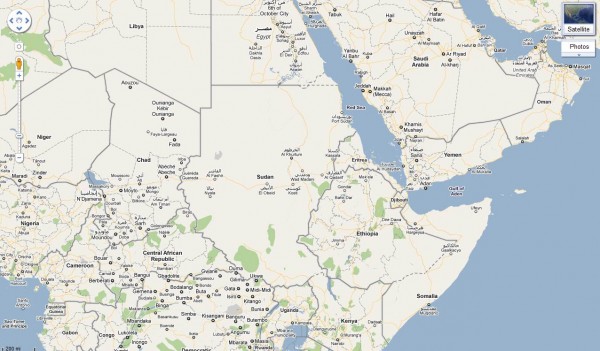
Sudan is a huge country (2.5 million km2), with an estimated population of 44 million people, but it’s poorly mapped. Without basic geospatial information, it’s difficult for humanitarian agencies and first responders to monitor and evaluate the risks and current needs, target their efforts, and mobilize proper resources. At times like these, it is critical to have good maps on roads, settlements, voting stations, hospitals, buildings and other services – with both local and official names – to generate better, faster responses.

This is one of the goals of the Satellite Sentinel project, which is using imagery, field reports and Google Map Maker to conduct human rights monitoring along the border between North and South Sudan. This effort is the result of an unprecedented collaboration between Not On Our Watch, Google, the Enough Project, the United Nations UNITAR Operational Satellite Applications Programme (UNOSAT), the Harvard Humanitarian Initiative, and Trellon, LLC.

If you have knowledge of Southern Sudan, an interest in mapping, and some free time, we encourage you to join the effort. With tools such as Google Map Maker and Sudan Vote Monitor, you have the opportunity to take concrete action by improving the map, helping to monitor and report human rights violations in near-real time and providing insight into the socio-political climate prevalent in the country and region.

Global Call for Action:
Together let’s build a better map of Southern Sudan. Your local knowledge and mapping contributions of schools, hospitals, and landmarks will be extremely useful to the humanitarian community to quickly build a picture of the situation, especially in these areas of interest.

Items that you can map:

  • Towns and town names (Arabic and local names especially)
  • Roads (in-town roads as well) and trails
  • Displaced persons camps
  • Cultural landmarks
  • Geographic landmarks
  • Schools
  • Orphanages, shelters etc.
  • Hospitals
  • Community centers
  • Border crossing points
  • Nomadic camps
  • Markets and large cattle gathering points

This is an opportunity to utilize the power of community engagement through mapping. We welcome you to get acclimated to Map Maker through our Getting Started page, and then invite you to join our Sudan-specific discussions.