New Google Earth Imagery – March 17

It’s been a little while since the most recent imagery update, but thanks to sharp-eyed GEB reader ‘Munden’, we’re now aware that Google has just pushed out a new update!

savannah.jpg

As is usually the case, you can use Google Maps to determine for sure whether or not a specific area is fresh. This new imagery isn’t in Google Maps yet, so you can compare Earth vs. Maps to see what’s new; the fresh imagery is already in Google Earth, but the old imagery is still in Google Maps. If you compare the two side-by-side and they’re not identical, that means that you’ve found a freshly updated area in Google Earth!

[UPDATED – 17-March, 11:31am EST]

  • Bahrain: Entire country
  • Canada: Quebec (Granby, Farnham) — thanks ‘Lurgee’
  • Germany: Kappeln, Bad Münstereifel, Wittlich, Kastellaun, Sinzig, Horb am Neckar, Rottenburg am Neckar and others — thanks ‘margin-auto’
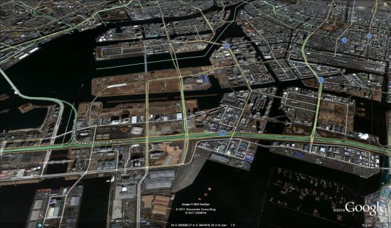
  • Japan: (pre-earthquake) Ishinomaki, Kakuda, Minamisoma, Nashushiobara, Soma, Tokyo, Tsuchiura, Tsukuba, Yokohama
  • Poland: Poznan — thanks ‘Paker’
  • Ukraine: Kiev — thanks ‘Roman’
  • United Kingdom: Wales (northern half)
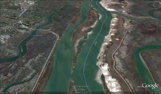
  • United States: California (Arcata, Lone Pine, Los Banos, Merced, Williams, Yuba City), Florida (Boca Raton, Gainesville, Ocala, Oxford, Palm Springs, Spring Hill), Georgia (Buchanan, Jefferson, Savannah), Kansas (Lawrence, Manhattan, Wamego), North Carolina (Asheville), Washington (Sequim, Carlsborg), Wyoming (much of Yellowstone Park including Old Faithful) — thanks ‘GT’ and ‘S B’

You Can find out where the Street View cars are currently on the road


Google has just released a major update to their Street View site with a handful of great new features. Notice that this isn’t new imagery, but it’s still quite cool for a few reasons.

Along with greater detail about the various Street View vehicles and your privacy, they’ve added an oft-requested feature: where the cards are currently driving. People often ask when imagery for their city will be updated, and now we get a nice glimpse at the answer.

Beyond that, you can learn the details of how the imagery from cars gets converted to Street View or check out their gallery of locations, which includes some amazing views.


gallery.jpg


New Google Earth imagery of post-earthquake Japan

GeoEye is moving very fast after the major earthquake and tsunami that struck Japan yesterday, already pushing out some fresh imagery from Tokyo, Kamaishi and Kushiro.

[UPDATE: Fukushima and Yokohama now available as well]

tokyo.jpg

To see the imagery for yourself, simply download the appropriate file below:

Tokyo: KML

Kamaishi: KML

Kushiro: KML

Fukushima: KML

Yokohama: KML

They’re posting continual update on the @EarthOutreach Twitter account, so stay tuned to that for the most recent imagery as it becomes available.

Also, they’ve just created a special Google Map to show all of the fresh imagery they’ve pushed out, so keep an eye on that as well.