The "GE Flight Simulator" gets update


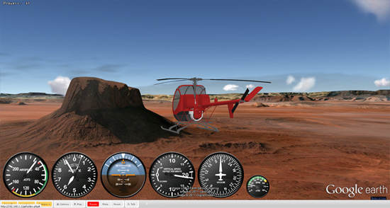
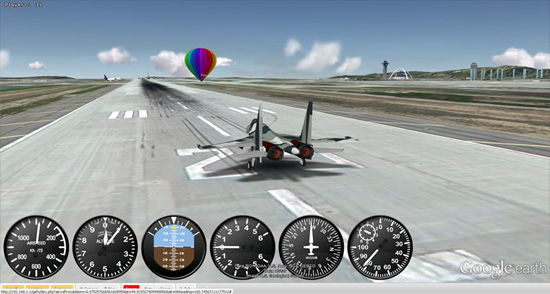
Late last year we showed you Xavier Tassin’s Google Earth Flight Simulator, which is a very well-built flight simulator that is powered by the Google Earth Plug-in.
 

1.jpg 

The site has seen solid growth over the past year, and now over 70,000 users visit each month, with 40 to 50 users connected at most times.

The latest version (.07) includes some nice upgrades:

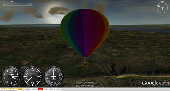
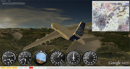
• 10 aircraft: from the Piper Cub to the A380, through Douglas DC3 and Sukhoi Su-35, helicopters and hot air balloon.

• A map rendering over 30,000 runways to take off from and DAFIF airspace charts (using Google Fusion Table and Google Maps)

• Real time, local weather conditions (Cloud coverage, wind speed), wind lift on relief.

• In-game chat

• Time slider to select current time of the day.

• Improved physics, animations, flight models, instruments and multiplayer

• Improved user interface, fine control settings, saved preference

This is another great example of why it’s so great to build games using the Google Earth Plug-in — Xavier has certainly made some great enhancements, but there has also been thousands of new 3D buildings (and 3D trees) added to Google Earth in the past year, making it even better!

You can try it for yourself at ge-flightsimulator.com or check out a few more beautiful screenshots below.
 

2.jpg 


3.jpg 


4.jpg

Geo APIs – Mapping Your Business

The Maps API is incredibly flexible, allowing developers to venture beyond the basics of web mapping into very different ways of displaying geospatial data and imagery. One way we chose to highlight this flexibility was in the I/O session “Map Your Business, Inside and Out.”

In this session, we demonstrated techniques for displaying custom data over a map, starting with a selection of locations spread out over the world, then zooming in repeatedly, ending with placing a specific object within a room.

In the video you’ll see how features in the API can be used to organize and display custom data at different zoom and conceptual levels. We talked about a number of concepts, demonstrating the power and flexibility of the Maps API. These included:

  • Overlay Tiler, a tool being developed that makes georeferencing and creating map tiles from an image simple and intuitive
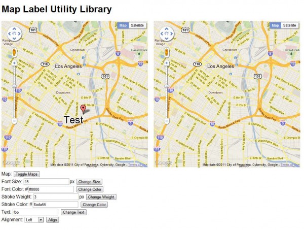
  • the MapLabel utility library, that provides functionality to label features on the map in a style that blends in with the standard Google Maps road and POI labels
  • a comparison of techniques to render floor plans on the base map
  • a simple UI control that allows switching between multiple floor plans over the base map
  • a simple search widget, that enables filtering over features on the map
  • a store locator, which uses Google Fusion Tables for geospatial storage, retrieval, and spatial queries
  • gathering and stitching imagery to create Custom Street View panoramas, linked to Google Street View panoramas.

Many of these techniques were used in the Google I/O 2011 Map. The source code for that project can be found on Google Project Hosting.

We hope that developers, armed with these techniques, can create compelling maps, enabling their users to navigate inside and outside the mapped locations.

Latitude API

With the recent addition of OAuth 2.0 support for the Latitude API, it is now easier than ever to start writing applications that utilize users’ location history or current location if they have opted in to sharing this information.

This post includes some examples of how you can use the powerful Latitude API to make compelling location-based applications.
Location History
There are many interesting ways you can use location history to create an interesting app. For example, Latify shows my location history on my Android phone so I can easily keep track of where I’ve been. You can use location history to answer questions like “Where was I on September 17th?” or you can analyze location history to show interesting stats. You can also export location history to Google Fusion Tables.
The possibilities expand when you use location history in conjunction with other data sets. For example, you can show location history lined up with transaction history, RSS feeds, or photo albums so users can see exactly where they were for a particular purchase, news event, or photo.
Current Location
The Latitude API allows you to access a user’s current location from a mobile device or a web server. For example, Moveable Weather allows users to call a phone number that tells them the weather based on their current Latitude location.
If you’re writing a mobile group messaging app, you can use the Latitude API to let users opt in to location sharing, allowing everyone in the group to see everyone else’s current location, without needing any location logic in your app.
These are just a few examples of the features of the Latitude API, which also includes storing location history, accessing city level location, and deleting location history. Check out the documentation to get started, or try browsing featured applications to get an idea of what you can build.