It’s Time to Improve Your Web Map App


Google had several new feature announcements for the Google Maps API in the last few months, including high resolution static maps, the new Street View Image API, and the use of high DPI map tiles in the JS Maps API on mobile devices. I’m here to give you some tips for using these new features to improve your existing mobile JS map app.

1. Upgrade Your App to Use the v3 API
If you’re still using the v2 Google Maps API it’s time to change that. Period. This is one of the best improvements you can make to your map app. The v3 Google Maps API was designed for the mobile web and it is significantly faster than its predecessor. Not only is the v3 Google Maps API designed to load fast on mobile browsers, but your app will be upgraded immediately because your map will automatically access high DPI map tiles, which have better on screen fidelity.

2. Use the Static Maps API to Improve User Experience
Check your Google Analytics data (or server logs) to see if your app is being accessed by devices with browsers that can’t or don’t fully support JavaScript. You can add logic to your app (e.g, server-side user agent checking) to determine whether you should serve your JS Maps API-based app or a static map image that shows the same or similar information. Although your users won’t be able to interact with the map, they’ll appreciate the ability to view the map. You can even add markers and other features to the static map. You’ll also be able to take advantage of the high resolution Static Maps API.


3. Use StreetView Images to Provide More Context
Chances are your map app gives users access to all kinds of information, whether it’s your own data and images or our very own Places API. Give your users some additional context by using the Street View Image API to provide a general idea of what a location looks like at street level. When you provide a location in your URL request, the API will snap to the panorama photographed closest to that particular location.

4. Use the JS Maps API Only When It Makes Sense
If all you need is a small map for context, you should be using the Static Maps API. This may seem obvious, but we’ve come across a few mobile apps that seem to use the JS Maps API to provide nothing more than a thumbnail. Use the Static Maps API to load a small image and, if needed, link that thumbnail to open up a larger map (whether your own page that uses the JS Maps API or maps.google.com).

And again, if you’re still using the deprecated v2 Google Maps API in any of your apps (mobile or otherwise), it’s time to migrate your app to the v3 Google Maps API, as Google are more than halfway through the three year deprecation period.

 

Zimbio launches Celebrity Places, powered by Bing Maps

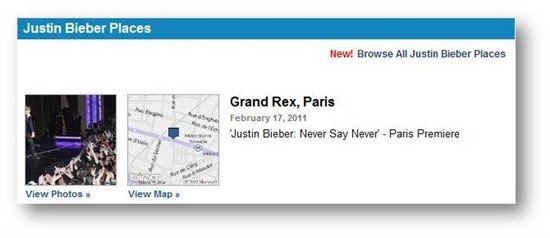
If you’re suffering from the latest epidemic, known as Bieber Fever, you may want to check out Zimbio’s newest feature: Celebrity Places for the cure. Zimbio is an interactive magazine publisher with a focus on entertainment, style, current events and a bevy of other pop culture topics.

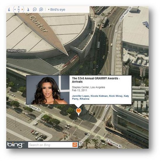
Their latest feature combines the accuracy and richness of Bing Maps with Zimbio’s high resolution photography of your favorite celebs. The idea is to synch a personality spotted in the wild with a location on the map, be it on the red carpet or grabbing a latte between shoots. There are over 10,000 geotagged photos on Zimbio.com in 1,000-plus cities and they are just getting started. Once you’ve found your celeb in the wild, you can find out more about them on Bing by clicking on the Bing logo and searching

Each celebrity has their own Places page, which will no doubt create an interesting destination for the Justin Bieber and Rihanna fans alike. The new feature is available today and is discoverable throughout the site.

The team at Zimbio did an amazing job integrating their high quality content with the Bing Maps v7 API. So, go to www.zimbio.com/places and check it out. The site was already stellar without the added geotagged content, so you will need to somehow substitute your Facebook browsing time with Zimbio Places…not enough hours in a day. Let us know what you think.

Travel inside of Art Galleries with Street View

Google has just unveiled the Google Art Project, which offers some amazing tools to help art lovers explore the venues and paintings that they enjoy.

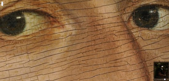
One of the neatest new features is the “brushstroke-level detail“, which allow you to see some of the images in astoundingly high resolution; nearly 7 billion pixels, roughly 1,000 times higher quality than you can capture with a digital camera. For an example of one, check out “The Merchant Georg Gisze” and use the [+]/[-] controls in the upper left corner to zoom in and out.

detail.jpg

The other great new feature they’ve added is Street View imagery inside of many of the world’s most famous galleries. To view them from Google Maps, simply go to maps.google.com/museums and browse the list of museums on the left.

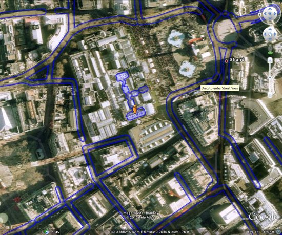
Even better is that you can view all of them from Google Earth, as long as you’re running Version 6. To enter a museum, simply grab the “Peg Man” from your controls in the upper-right corner and drag him onto one. You’ll see the blue Street View lines appear more “blob-like” over museums, as seen below:

pegman.jpg

This kind of imagery is currently available for 17 galleries, including places such as the Freer Gallery of Art in Washington D.C. (KML), the Metropolitan Museum of Art in New York City (KML), and the National Gallery in London (KML).

For more information, check out the post on the Official Google Blog, or simply head over to www.googleartproject.com.