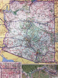
Somewhere on the back seat of the car—I think it’s under a history of Beloit College’s radio station and a scattering of brochures promoting tourist attractions I’ll never visit—is a “Deluxe Edition” 50-state Rand McNally road atlas. Chances are good that at some point you’ve pored over the road atlas’s big pages, with their pale-purple state borders and pastel parks, trying to plot some long-ago trip to the beach or the mountains. Or maybe you’ve tried to use one of those frustratingly small inset city maps (“Tucson” or “Central Phoenix”) to get from your Best Western to that Mexican restaurant the desk clerk described.
Chances are also good, though, that nowadays you use the road atlas a lot less, if at all. As of last night, I’ve driven 3,402 miles since this road trip started, and the atlas hasn’t been out of the back seat once. Instead I’ve trusted Google’s maps and algorithms and my iPhone, which has spent a lot of the trip balanced on my right knee. Aside from one Holiday Inn Express that Google misplaced, they’ve been a great pair.
In a way, I miss relying on the atlas (though not enough, apparently, to open it). A full-page map of whatever state you’re in, or are planning to visit, offers context that Google Maps does not, not even on a full-size screen. So it was fun to run into James Akerman, director of the Center for the History of Cartography at the Newberry Library in Chicago, at a bed-and-breakfast a block from Grinnell College. He was in town to give a lecture at the college, and he took time out to talk to me about the history of road maps.
Rand McNally, Mr. Akerman said, got started as a Chicago printing company that did a lot of work for railroads—”that’s how they got involved in cartography.” Not long after the dawn of the automobile age, the company also began producing road maps for oil companies, which gave them to customers as a way of encouraging brand loyalty. Rand McNally’s two big competitors in the road-map business were the General Drafting Company and H.M. Gousha Company, Mr. Akerman said. The maps were updated annually and were “very accurate,” he added.
All three companies had recognizable house styles, although their maps were customized for different clients, which also included hotel chains and some tire companies. “Sometimes on the back of the map there was a pictorial guide to the region, with scenic attractions,” Mr. Akerman said, and some of the oil companies even offered travel bureaus that helped customers plan their trips.
By the mid-1960s, he said, some 200 million road maps had been given away. The beginning of the end, though, came when gas prices soared during the energy crisis of the early 1970s. The oil companies started looking for ways to cut costs, and after gas rocketed above $1 a gallon, customers pretty much abandoned whatever brand loyalty they’d had—it had always been a fleeting thing, one gasoline being pretty hard to distinguish from the next. Free maps went the way of give-away drinking glasses and, eventually, full-service gas stations.
The oldest items in the Newberry Library’s collection of auto-oriented cartography include maps produced before the creation of the numbered highway system. Drivers navigated routes with names like the Lincoln Highway and the Dixie Highway; the road that runs through the town of Grinnell was once known as the Roosevelt Highway, Mr. Akerman said. The numbered highways—Route 66, of course, was the most famous—were in turn supplanted by the interstates. As Mr. Akerman put it, the interstates “insulate us from the landscape,” cushioning drivers with blue-signed rest areas and a seemingly endless supply of Golden Arches.

