Hurricane Irene, which has already done some serious damage to Puerto Rico, was recently captured in stunning high resolution by NASA’s Terra satellite as it heads toward the east coast of the United States.
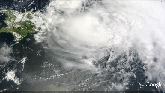
You can view the image on NASA’s Earth Observatory website, or view it in Google Earth using this KML file. Be aware the KML is loading the full 5 MB file from NASA’s server, as it’s amazingly sharp, so it’ll take a few moments to load.
To track the Hurricane and view it’s forecasted track, turn on your Places layer and an icon will appear over the Hurricane. Clicking that icon will give you access to details about the Hurricane, along with historical data and various projected paths.
See also New York Times Hurricane Irene Tracking Map
