The Arctic Tern and the Sea Grapes


Last fall we showed you a great file from the people at Encyclopedia of Life that tracked Bluefin Tuna across the Atlantic. They’re back with a few new files that show how a type of sea algae (known as “sea grapes”) and Arctic Terns travel across the world as part of their annual migrations.


tern.jpg 

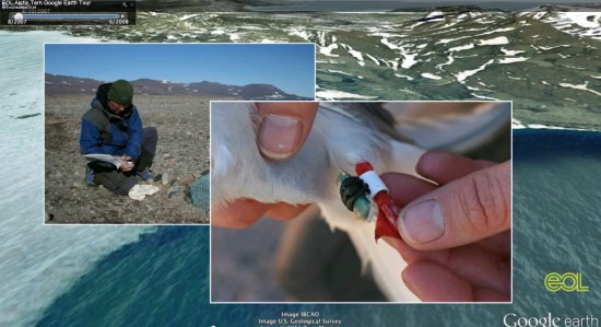
Ari Daniel Shapiro has worked with others, including Marie Studer and Eduardo Garcia Milagros, to put together some remarkable new tours. Ari’s background is in radio, so the audio narrative on the tours is excellent. Combine that with the images, video and Google Earth content and you’ve got a very engrossing and educational result.

The tours are available below, both in KMZ format for you to enjoy:

Sea Grapes Tour | KMZ


Arctic Tern Tour | KMZ


For more, you can view all of their tours on the Encyclopedia of Life site.

Google Earth: The city lights


The “Earth at Night” layer remains a very unique way to view the earth. Captured on the “dark side” of the planet, depending on the time of day, the images are a striking visual of the more urbanized areas of the planet.


lights.jpg 

However, the images were not easy to capture. For years, astronauts would try to capture the bright lights and only have blurry photographs to show for it, as the earth travels beneath them at 4.4 miles/second.

In 2003, Don Pettit developed an innovative system for capturing these images and he went on to capture over 2,500 photos, with thousands more captured in subsequent missions. You can read more about Don and his technique in this article at Air & Space Magazine.

To see the lights for yourself, simply click on the [Layers] in Google Earth, open [NASA], then [Earth City Lights] and click the button in there.. For the best results, disable your other layers and places to get a nice clean view of the earth. You should likely disable the atmosphere as well (under [View] –> [Atmosphere]), but I kind of like the glow it gives. It’s a neat effect.

A big thanks to Don for pioneering this amazing technique, and hopefully as time goes on this imagery will become even higher-quality and more striking.

Google Street View is mapping Bulgarian streets soon

Google is now ready to finally begin touring the streets of Bulgarian cities and towns, a report by website dnevnik.bg claimed on February 14.

Google Street View, which offers panoramic views from a particular spot alongside a street, can be used both through Google Maps and Google Earth applications.

It was unclear which cities Google’s camera cars will tour first, but the list of destinations included all the major cities – Sofia, Varna and Plovdiv – as well as about 70 towns. The list included all of Bulgaria’s major winter (Borovets, Bansko, Pamporovo) and summer resorts (Slunchev Bryag, Zlatni Pyassutsi, Balchik and Sozopol, among others), as well as historical towns like Koprivshtitsa and Melnik.

As is in other countries, Google will blur out faces and licence plates of cars caught on camera. Separately, people will have the option to ask Google to blur out photos of their property if they so desire.

The report did not specify an expected date for when street views of Bulgarian cities and towns would be available, given that it will take several months to process the photos and string them together.