Maps+Motion

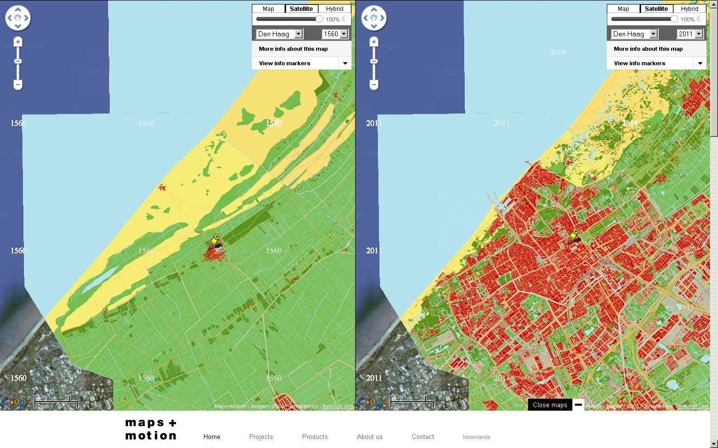
Mapsplusmotion is making a digital historical atlas which shows at a glance how a city or a country has grown and changed over the centuries. The digital historical map forms the basis for educational presentations, and interactive and online applications. The applications of Mapsplusmotion are particularly suitable for educational projects in museums and historical-geographical access to heritage collections. As well as animation films and a custom-made historical layer in Google Maps, we supply interactive educational applications and printed material.

Google Earth Imagery – July 16


Thanks to sharp-eyed GEB reader ‘Andy’, we see that Google has just pushed some fresh imagery into Google Earth. It’s been a longer delay than we normally see between updates, but it looks like it might be a fairly substantial one!


crete.jpg 

As is usually the case, you can use Google Maps to determine for sure whether or not a specific area is fresh. This new imagery isn’t in Google Maps yet, so you can compare Earth vs. Maps to see what’s new; the fresh imagery is already in Google Earth, but the old imagery is still in Google Maps. If you compare the two side-by-side and they’re not identical, that means that you’ve found a freshly updated area in Google Earth!

[UPDATED – 16-July, 11:417am EST]

  • France: Autun, Morhange
  • Germany: Picher, Rastow, Samerberg, Wobbelin
  • Greece: Chametoulo, Ierapetra, Kymi, Santorini Island
  • Mexico: Various — thanks ‘augusto’
  • Poland: Lanieta
  • Romania: Various — thanks ‘twist3r’ and ‘spiderpc’
  • Spain: Aranda de duero, La Carolina
  • United States: Idaho (Boise) and New York (Manhattan, Syracuse) — thanks ‘AndreasK’ and ‘Jonas’