London Low Life mapping project

This week, we’re happy to begin a 30-day preview of one of our most distinctive interactive mapping projects: The London Low Life Map. This map was produced for Adam Matthew Digital, a digital publishing company based in the UK. Adam Matthew produces digitized archives of historic primary source documents, collected around a central theme, for higher education institutions. This map was built as part of their London Low Life collection that explores the seedy underbelly of Victorian London. It examines the documents of sex, drinking, gambling, and the institutions that sprang up to combat those very vices. As the map is integrated into Adam Matthew’s collection, we will only be able to grant access to our readers for 30-days. I encourage you to explore the map and enjoy Adam Matthew’s fantastic collection of historic maps and images. Since we’ve pulled the map out of the collection, I wanted to give you some context on what is included.

View the map >>

London Low Life-2-2

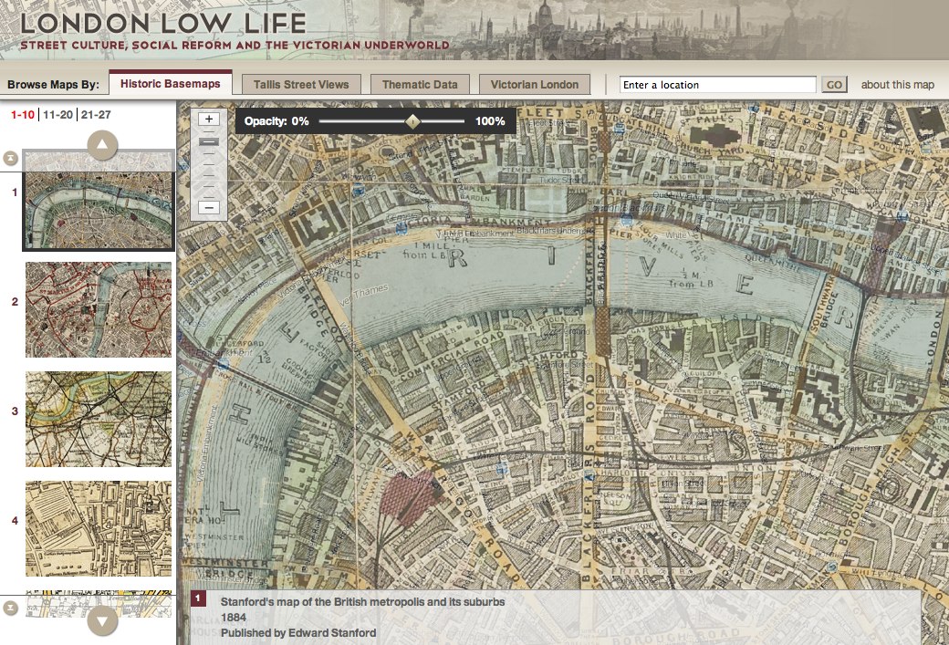
Historic Basemaps

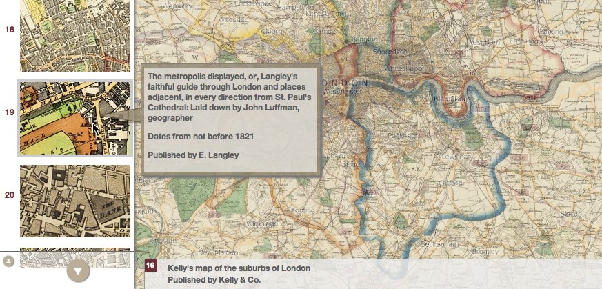
The full London Lowlife project gives users access to a mountain of primary source documents from Victorian London, so it only makes sense that we start with maps made of greater London during this era. We’ve included some metadata with each of these maps (author, date, publisher) to give historical context and placed them on top of a custom Cloudmade basemap (with adjustable opacity) to give some modern context as well.

London Low Life-3-2

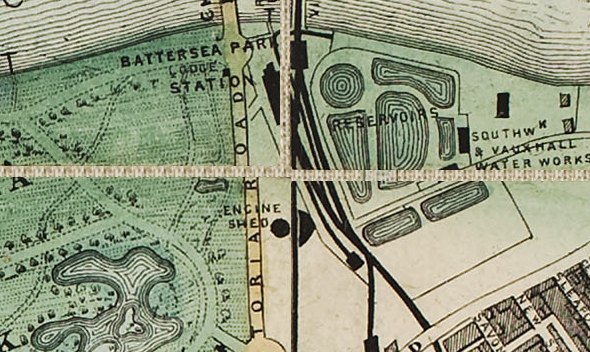
Taking these historical maps from raw image to geographically accurate overlay was an incredibly intricate procedure. While some maps existed as single, contiguous images, others were scanned in their current forms as pages, separated by fraying canvas. Before we could rubbersheet the maps to OpenStreetMap data (with the help of the UW Cart Lab), we had to manually remove the seams and align the resulting image fragments to one another. Furthermore, because these maps were at different sizes and scales, we had to build a system that would identify maps with limited resolutions and restrict the zoom levels available on the fly.

standford1884.tif-1-2

It’s fascinating to view the changes in the street maps over time, especially which streets were given primary status then and now.

Tallis Streetviews

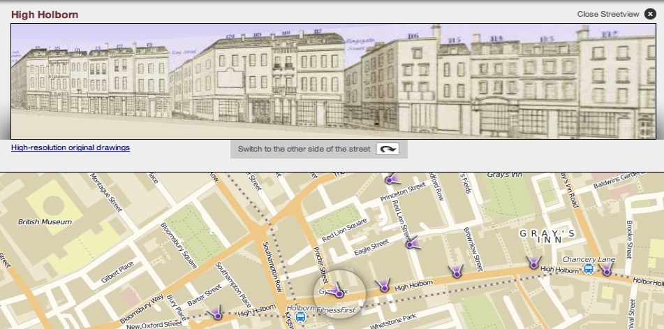
In the mid-nineteenth century, John Tallis drew detailed views of the fronts and façades of buildings along Central London’s streets. Originally designed as a “visual yellow-pages” (businesses would pay to have their shops labeled), his 88 plates now survive as a first-person perspective into the streets of Victorian London.

London Low Life-4-2

We wanted to make these plates as immersive as possible. With the help of AMD’s editorial staff, we took Tallis’ original image and added some color to sharpen the images, shadows to depth, and a blue-sky background to increase the realism of the images. Finally, the images were run through Google Sketchup to create the perspective views that place you in Victorian London and allow you to look down either side of the street.

Be sure to click the “view original” button to see the original plates to view the intricate detail surrounding the street images.

Thematic Data

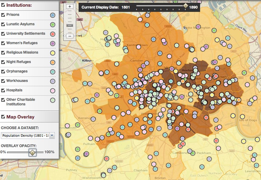
While the historic basemaps and Tallis Streetviews of the London Lowlife map attempt to provide insight into the qualitative aspects of Victorian London geography, we also wanted to explore the changing character of the population through quantitative thematic mapping. Simple demographic measures like population and density can provide a major insight into the nature of a city. However, we believe the most telling indicator of life in Victorian London, and certainly true to the name “low life” ascribed to this project, is the explosion in social services that sprung up throughout the city to deal with the new urban population.

London Low Life-5-2

By dragging the timeline to view an animation of the entire century, you can watch population increase in various sections of the city and then the services emerge to try and meet the need.

Victorian London

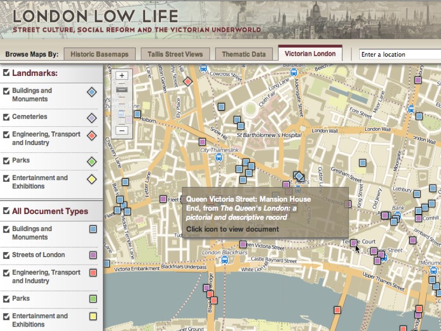
The final section of the map gives a taste of the larger London Lowlife project by placing a selection of the primary source documents on the map. It’s an engaging way to explore city by viewing some fantastic records of the landscape and people of Victorian London.

London Low Life-6-2

Mouse over a category point on the legend list to quickly highlight all corresponding points.

View the map >>
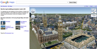
Google Earth: View of the wedding procession

Connected with  the marriage of Prince William and Catherine Middleton, many locations in central London are in the spotlight. Last month we expanded our 3D imagery of central London’s buildings and trees in Google Earth to help you explore the royal wedding procession route.

As we get closer to the wedding day, we’ve also featured a few highlights along the procession route for you to explore in 3D using Google Maps with Earth View. If you have the Google Earth plug-in installed, you can get started viewing these spots though an immersive tour right away, or you can download the Google Earth plug-in to explore Google Maps in 3D.

With one click, you can travel to Buckingham Palace, fly to an aerial perspective of Westminster Abbey, or get a clock-level view of Big Ben and the Houses of Parliament. Get started seeing these and other highlights at maps.google.com/royalwedding.

Houses of Parliament & Big Ben, London

Whatever way you’re celebrating on Friday, we hope this rich data of London in Google Earth and Google Maps brings you that little bit closer to this historic event.

Parsing Free-Text Addresses and a UK Postcode Regular Expression Pattern

We’ll be attempting to replicate the functionality of Google Maps using nothing but freely-available tools and data – SQL Server Express, OS Open Data, and a dash of Silverlight.

One of the features I’ll be demonstrating is a basic geocoding function – i.e. given an address, placename, or landmark, how do you look up and return the coordinates representing the location so that the map can centre on that place? This is not really a spatial question at all – it’s a question of parsing a free-text user input and using that as the basis of a text search of the database.

The simplest way of doing this is to force your users to enter Street Number, Street Name, Town, and Postcode in separate input elements (and these match the fields in your database). In this case, your query becomes straightforward:

SELECT X, Y FROM AddressDatabase WHERE StreetNumber = ‘10’ AND StreetName = ‘Downing Street’ AND Town=’London’

Most databases don’t contain the location of every individual address. If there is no exact matching StreetNumber record, then you typically find the closest matching properties on the same road and interpolate between them (it seems reasonable to assume that Number 10 Downing Street will be somewhere between Number 9 and Number 11).

Forcing users to enter each element of the address separately doesn’t necessarily create the most attractive UI, however. What’s more common is to use a single free-text search box into which users can type whatever they’re searching for – a placename, address, landmark, postcode etc. Nice UI, but horrible to make sense of the input. In these cases, the user might supply:

“10 Downing Street, London”

“Downing Street, St James’, LONDON”

“10, Downing St. SW1A 2AA”

…not to mention “10 Downig Street. London”, and any other many of misspellings or alternative formats.

One approach you might want to take in these cases is to use a RegEx pattern matcher to determine if any part of the string supplied is a postcode. The UK postcode format is defined by British Standard BS7666, and can be described using the following regular expression pattern:

(GIR 0AA|[A-PR-UWYZ]([0-9][0-9A-HJKPS-UW]?|[A-HK-Y][0-9][0-9ABEHMNPRV-Y]?) [0-9][ABD-HJLNP-UW-Z]{2})

Matching the supplied address string against this RegEx doesn’t prove that a valid postcode was supplied, but just that some part of the user input matched the format for a postcode. The matching substring can then be looked up (say, against the CodePoint Open dataset) to confirm that it is real.

Once you’ve identified the postcode, you can then run a query to retrieve a list of roadnames that lie in that postcode, from something like the OSLocator dataset, and scan the remainder of the input to see if it contains any of those names. You can also scan for any numeric characters in the first part of the text input, which might represent a house number. If you find a matching property, with the same road name and valid postcode, you can be pretty sure you’ve found a match.

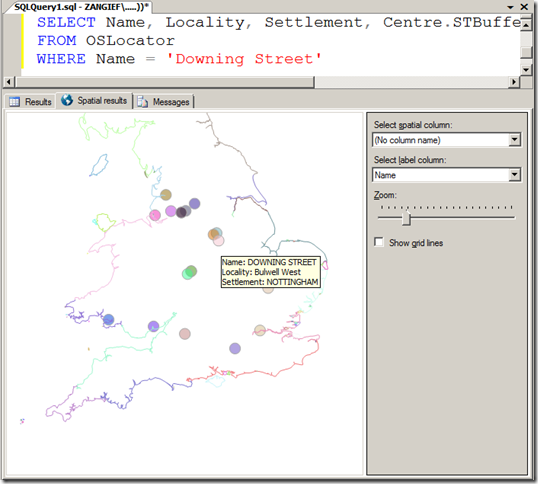
If you find more than valid match, or possibly several partial matches only, then you can of course present a disambiguation dialogue box – “Is this the 10 Downing Street you meant?”. For example, there are many “10 Downing Street”s in the UK – from Liverpool to Llanelli and Farnham to Fishwick…. without knowing either the town or the postcode, it could have referred to any of the following:

image