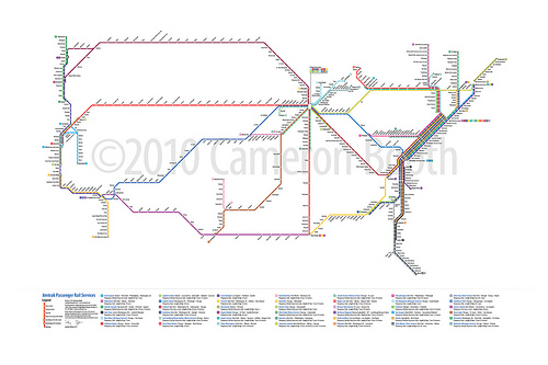
Amtrak Routes as Subway Diagram

Amtrak Passenger Rail System

Cameron Booth writes: “A while ago, you featured my U.S. Interstates as London Underground Diagram poster on The Map Room. Along a similar line, here’s a link to my latest project: a subway-style map of Amtrak’s passenger rail routes. It shows every station and also clearly shows which routes serve them, using the familiar color-coding of a subway map. (Neither of which Amtrak’s current, geographically accurate service map does!)”

Previously: U.S. Interstates as Tube Map.

Amtrak Routes as Subway Diagram first appeared on The Map Room: A Weblog About Maps on November 6, 2010. Copyright
From Buildings to Cities: Techniques for the Multi-Scale Analysis of Urban Form and Function

Duncan Smith here at CASA and Andrew Crooks, an assistant professor in the Department of Computational Social Science, at George Mason University have just finished a new working paper entitled ” From Buildings to Cities: Techniques for the Multi-Scale Analysis of Urban Form and Function .” Below is the abstract : The built environment is a significant factor in many urban processes, yet direct measures of built form are seldom used in geographical studies. Representation and analysis of urban form and function could provide new insights and improve the evidence base for research. So far progress has been slow due to limited data availability, computational demands, and a lack of methods to integrate built environment data with aggregate geographical analysis.

San Francisco Tweetography: Twitter Landscapes

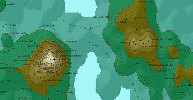
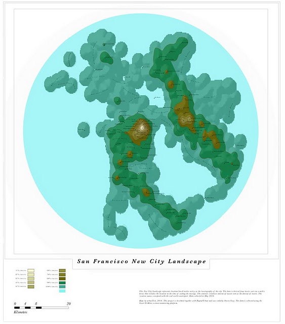
Our geo-located twitter data mined from San Francisco has now been processed to create a new look at the city.

Processed by Fabian Neuhaus, a PhD student here at CASA, University College London, the new city twitter topography creates a unique new media landscape. The data is mined via our ‘Tweet-O-Meter’ system (soon to be seen in physical form in the British Library) which collects all geo-located tweets within a 30km radius of world cities.

You can view a full screen Google Maps style version of San Francisco over at Urban Tick as well as the previous maps of London, New York, Munich, Paris and Moscow.