Last year, Laura Hillenbrand released a book titled “Unbroken: A World War II Story of Survival, Resilience, and Redemption“, based on the life of Louis Zamperini (details on Amazon). The book has been very popular, quickly becoming a best-seller and recently being picked up by Universal Studios to be turned into a movie.
The life of Zamperini is amazing, and the book is excellent. Zamperini, a world-class runner that competed in the Berlin Olympics in 1936, is drafted into World War II. He fights a number of missions before his plane goes down and he’s trapped in a raft at sea. After 46 days at sea, he floats into the Japanese-controlled Marshall Islands, and he’s placed in various POW camps for the next few years.
In reading the book about his journey, I realized that it would pretty cool to track down his various missions and POW camps in Google Earth. I was right! However, I was unable to find a decent timeline of his life, so I spent a few hours researching it and created one myself. After that, I did more research to find all of those locations in Google Earth and ended up with a pretty cool file.
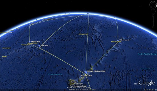
The file includes locations from his early days (homes, school), the various places he went for military training, the Pacific missions he completed, the POW camps he was placed in, and the various stops on his journey home. You can download the KMZ file here to try it for yourself.
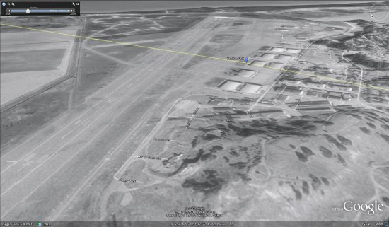
I had hoped that historical imagery might come into play with this, but the old imagery in the Pacific and Japan doesn’t go back nearly far enough (as opposed to Europe, where many locations have historical imagery dating back to the mid-1940’s). However, one good example was Hamilton Field, where he stopped over on his way to Hawaii. The present-day imagery no longer shows a runway, but if you switch to the 1993 imagery you can clearly see the runway still there.
All of that being said, I’m sure the file isn’t perfect. If you make any corrections to it, please email me the updated version (mickey@gearthblog.com) and I’ll update this post.