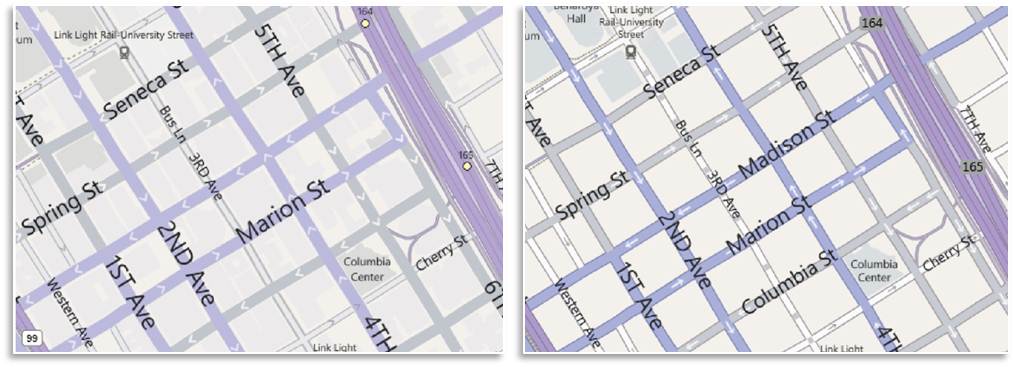
Over the past few months, we’ve been testing some enhancements to the Bing Maps interface that we’re excited to now make available for everyone. The most apparent changes are to our task and navigation controls, where—based on your feedback—we’ve made it easier to find the most common actions to complete your task at hand.
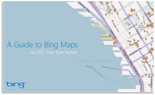
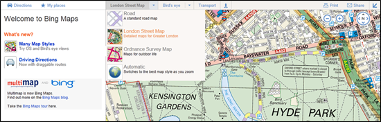
For reference, here’s the previous design (pay particular attention to the top and bottom of the page):
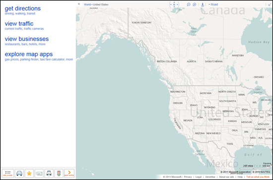
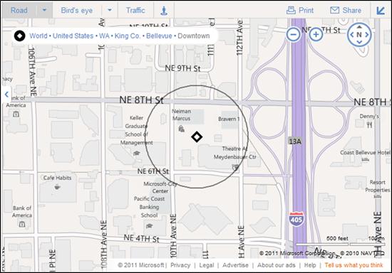
Here’s the refreshed version:
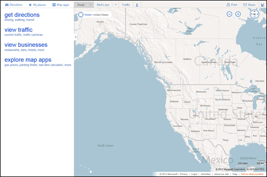
We’ve consolidated actions that were previously scattered throughout the page, and concentrated them along the top, where you expect to find them. We’ve included text labels for most of the buttons. And, most importantly, we’ve focused on making the controls accessible while still allowing the map to be the focus of the page.
These improvements are being rolled out to all of our international sites with appropriate market-specific functionality. For example, Bing Maps users in the UK will still have access to the London Street Map and Ordnance Survey styles, along with our standard Road map, via the vector style drop-down. The public transport overlay, showing tube, DLR, and tram networks, is also readily available from the navigation bar when the map is centered over the greater London area.]
You’ve told us you love our unique Bird’s eye 45-degree perspective, viewable from all four compass directions, as well as our high resolution Aerial imagery (see the recent blog post on the Global Ortho Project for more details). As a result, we’ve improved access to these imagery types by making them directly accessible from the top of the navigation bar. At the same time, you can now more easily switch between various road and imagery styles with a single click. You also have the option to view either of the imagery styles with or without labels, depending on your preference.

TIP: Automatically center the map on your current location
If you’re visiting Bing Maps with a browser that supports the W3C Geolocation API, you’ll find a new button (calledlocate me) available to the left of the breadcrumb that, when clicked, will center the map on your current location as reported by your browser.

You’ll receive the highest accuracy results—including a pin and approximate radius—when using a computer with WiFi enabled. You can turn off the pin by clicking the button again. (Note: all browsers will prompt you to share your location after you click the locate me button; if you choose not to allow access, Bing Maps will be unable to center the map on your location.)
We hope you find these changes make Bing Maps simpler and more efficient to use as you focus on completing your map-focused tasks!