Updating Your Listing Automatically in Google Places

Days ago Google Places announced on the LatLong Blog that they would automatically update claimed listings more quickly with information from trusted third parties and end users if Google thought the information was more accurate than information that was in the Places Dashboard. They noted:

But now, if a user provides new information about a business they know — or if our system identifies information from another source on the web that may be more recent than the data the business owner provided via Google Places — the organic listing will automatically be updated and the business owner will be sent an email notification about the change.

The policy of changing claimed listings to match what Google claims is more accurate information is not new. They implmented this programlate last year with a 60 day window. Now however the speed with which Google will do the update apparently is.

The previous letters, which also would includ notification of impending status changes like “Permanently closed”, were not sent reliably.

Here is a copy of the letter that is being sent. In this example, it appears that the only information change is to add the last 4 digits of the zip+4 number. In another instance I received, Google was suggesting changing the listing to an 800 instead of the local number that was in the Places dashboard:

Your listing on Google Places will soon be updated
Dear Google Places user,Google will soon update your listing data on our consumer properties such as Google and Google Maps to more accurately reflect the latest information we have about your business.

We use many sources to determine the accuracy of our listing data and to provide the best possible experience for business owners and consumers who use Google and Google Maps to find local information.

Below is a summary of what your listing(s) will contain once it’s updated in the next few weeks. This will be visible on your Place page and listings across Google properties, but it will not be reflected in your Google Places account:

Blumenthals.com

201 North Union St # 307, Olean, New York, 14760-2740, US

+1 7163724008

http://www.blumenthals.com/

If the above information is not accurate, please sign in to Google Places. You may prevent any of these changes from being made on your Place page and listing by selecting “Edit”, and then pressing the “Submit” button to confirm the correct information about your business.

If you submit data to Google via a feed, please ensure that the data in your feed is accurate and current. Note that you must update listing data in your feed to prevent changes from being made to the above listings.

Note that if you are an AdWords or AdWords Express customer, your ads will be unaffected by this change and will continue to display the listing information you have provided in Google Places. To manage your online advertisements, please sign into Google Places or Google AdWords.

For more information about updates to claimed listings, please visit: http://www.google.com/support/places/bin/answer.py?hl=en&answer=1318197

Sincerely,

The Google Places Team

(c) 2011 Google Inc. 1600 Amphitheatre Parkway, Mountain View, CA 94043

You have received this mandatory email service announcement to update you about important changes to your Google Places product or account.

The program’s goal is to improve index quality. If implemented carefully it can work. It is not clear how abuse proof the program is and how much trust Google will put in end user edits. Obviously many of those, if not properly vetted, could create a whole new spate malicious activity.

There is also some irony that a Google forced change to a listing could occur significantly faster than an owner change to the description or category fields.

I for one though will be grateful to stop receicing those stupid emails indicating that a problem I just reported via the report a problem link on my own record might not be updated because:

You should know, however, that XXXX is an owner verified listing and some updates require the approval of the business owner before they can take effect.
Building a healthier, greener Google

When it comes to greening our office buildings, we apply the same focus that we use for any of our products: put the user first. We want to create the healthiest work environments possible where Googlers can thrive and innovate. From concept through design, construction and operations, we create buildings that function like living and breathing systems by optimizing access to nature, clean air and daylight.

Since I arrived at Google in 2006, I’ve been part of a team working to create life-sustaining buildings that support the health and productivity of Googlers. We avoid materials that contain volatile organic compounds (VOCs) and other known toxins that may harm human health, so Googlers don’t have to worry about the air they’re breathing or the toxicity of the furniture, carpet or other materials in their workspaces. We also use dual stage air filtration systems to eliminate particulates and remaining VOCs, which further improves indoor air quality.

Since building materials don’t have ingredient labels, we’re pushing the industry to adopt product transparency practices that will lead to real market transformation. In North America, we purchase materials free of the Living Building Challenge Red List Materials and EPA Chemicals of Concern, and through the Pharos Project we ask our suppliers to meet strict transparency requirements.

We also strive to shrink our environmental footprint by investing in the most efficient heating, cooling and lighting systems. Throughout many of our offices, we’ve performed energy and water audits and implemented conservation measures to develop best practices that are applied to our offices worldwide. To the extent possible, we seek out renewable sources for the energy that we do use. One of the earliest projects I worked on at Google involved installing the first solar panels on campus back in 2007. They have the capacity to produce 1.6 megawatts of clean, renewable electricity for us, which supplies about 30 percent of our peak energy use on the buildings they cover.

With a little healthy competition, we’ve gotten Google’s offices around the world involved in greening our operations. Our internal Sustainable Pursuit program allows teams to earn points based on their office’s green performance—whether it’s through green cleaning programs, water efficiency or innovative waste management strategies. We use Google Apps to help us track progress toward our goals—which meet or exceed the U.S. Green Building Council’s LEED standards—and share what we’ve learned among our global facilities teams.

We’re proud of our latest LEED Platinum achievement for the interior renovation of an office building at the Googleplex. While we have other LEED Platinum buildings in our portfolio, it’s a first for our headquarters and a first for the City of Mountain View. The interior renovation was designed by Boora Architects and built by XL Construction, using healthy building materials and practices. In fact, we now have more than 4.5 million square feet of building space around the world on deck to earn LEED Certification.

via Green blog

Hike down geotagged memory lane with GPSMAP 62’s built-in camera


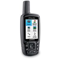
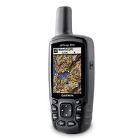
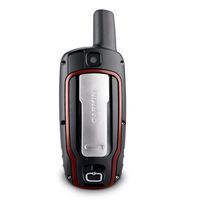
We’re wrapping up our exciting week of product announcements with an addition to the GPSMAP 62 series of rugged outdoor handheld devices – a built-in 5 megapixel camera with automatic geotagging to capture the highlights of any adventure and allow you to share the locations or navigate back to that site. We’re showing off GPSMAP 62stc and GPSMAP 62sc here at the Teva Mountain Games in Vail, CO, capping four days of fun that included this and other big news in the popular eTrex, Rino and Astro families.

Hikers, hunters, mountain bikers and other outdoors enthusiasts often don’t have the time or energy to dig through their pack every time they see something memorable or worth sharing later,” said Dan Bartel, Garmin’s vice president of worldwide sales. “The built-in camera seamlessly integrates photography into your basic navigation, whether you’re out for a day of leisurely sightseeing or serious reconnaissance – or simply trying to get back safely to where you started.”

Picture perfect: Whenever a picture is taken in stunning clarity with the 5 megapixel, auto-focus camera on GPSMAP 62stc or GPSMAP 62sc, the photograph is geotagged – meaning the location is saved and encoded into the file – so that the geographical information can be used at any time as a point of reference or as a destination that can be reached through GPS guidance and directions. And because the GPSMAP family is waterproof to IPX7 standards, the built-in camera will still be snapping photos even in the worst conditions. Ample built-in memory (3.5 GB for both models) allows you to take plenty of pictures on the trail and save the downloading and deciding for later. Once your GPSMAP 62stc or GPSMAP 62sc is connected via USB, you can use Garmin’s free BaseCamp software (http://garmin.com/basecamp) to easily store and share your photos. BaseCamp also helps you view, plan and organize your maps (in 2D or 3D), waypoints, routes and tracks – including elevation profiles – and send them to your Garmin handheld.Options abound: Boasting a 2.6” sunlight-readable color display, intuitive push-button interface, up to 16 hours of battery life and a high-sensitivity GPS receiver and quad helix antenna for unparalleled reception, the GPSMAP 62 series features various models and custom dashboards to suit various activities and interests. And thanks to enhanced navigation and the 3D digital elevation model (DEM) data, users navigating to a destination on an active track will see changes in elevation ahead as well as where they’ve been. Also, waypoints and other key locations along the active route – such as start, end and high and low elevation points – appear on the map and active route pages. When choosing the best model for your lifestyle, it’s easy to remember that the “s” stands for integrated sensors (electronic compass and barometric altimeter), “t” denotes preloaded topographic maps, and “c” indicates the built-in camera described above. Learn more about the GPSMAP 62 models and features at the interactive minisite at http://www.garmin.com/gpsmap62.

What’s inside: GPSMAP 62 models with an “s” include a 3-axis tilt-compensated electronic compass and wireless connectivity for sharing routes, tracks, waypoints and geocaches between other compatible Garmin handhelds. These models feature a barometric altimeter that tracks changes in pressure to pinpoint your precise altitude. Users can also plot barometric pressure over time, which can help keep an eye on changing weather conditions. These devices also use ANT+ for wireless sharing between compatible devices, monitoring heart rate and cadence with those optional accessories, and interacting with chirp geocaching beacons (www.garmin.com/chirp).

Taming the terrain: GPSMAP 62 models with a “t” in the name feature preloaded 100K topographic maps for the entire United States (or preloaded 50K topographic mapping of Canada for the Canadian version). Detailed coverage includes major trails, urban and rural roads, interstates, highways, coastlines, rivers and lakes as well as national, state and local parks, forests and wilderness areas. In addition, you can search for points of interest by name or proximity to your location and view descriptive details for terrain contours, topo elevations, summits and geographical points.