As Google often does during disasters (such as the Gulf Oil Spill and the Japan Earthquake, Google has set up a Crisis Response page to help provide information for those trying to assist with the flooding in Thailand.
The flooding has become quite devastating and more widespread than most people realize. From Google’s page:
Thailand is currently facing its worst flooding in 50 years. Flood waters have swamped more than two-thirds of the country, submerging rice fields and shutting down hundreds of factories while over 900,000 families and businesses have been impacted and hundreds of lives have been tragically lost. National relief efforts are now focused on providing essential food, clean water and shelter to displaced people and restoring damaged infrastructure to the Kingdom of Smiles.
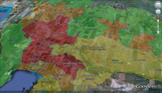
You can use the map on their page, or download various elements as KML files to be able to browse them in Google Earth. For example, here is the “Flood affected areas across Thailand” map (KML ), which gives you a quick glance at the hardest hit areas.
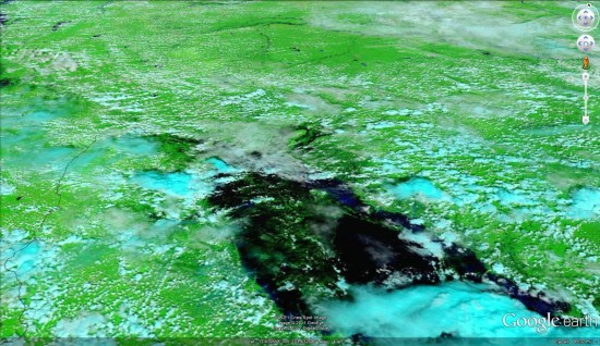
For fresh satellite imagery of the area, you can use the imagery released by the NASA Earth Observatory a few days ago. You can view the image on their site.
Google Maps Mania

 Night Lights: Very similar to the
 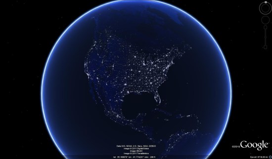 Colored Edges: There are a variety of Photoshop-edited overlays in here as well; various blurs and effects. Here is one called “colored edges” that is pretty neat.
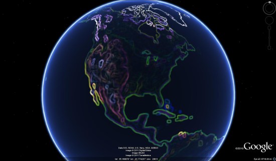 They also have a collection of solid color overlays. These overlays are completely solid, effectively hiding the base imagery so that roads, borders and other items are more well-defined. Here is the dark red version of that, with the “Borders and Labels” and “Roads” layers turned on.
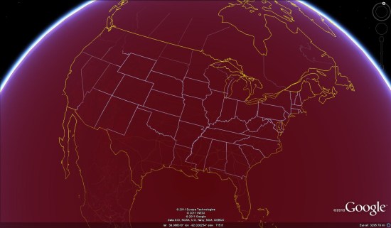 Like most maps of this variety, it fades away as you zoom in closer to reveal the base imagery. This allows you to run your favorite overlay all the time, as it will automatically hide itself when you zoom in close enough to look at the details of a specific location. The exception is a special version of the “solid black earth”, which is set to never turn off when you zoom in. They offer both versions, so the choice is up to you.
 . To see more of what they have to offer, visit their site at