Google Earth New Imagery – March

It’s been a little while since the last update, but it appears that Google Earth has pushed out some fresh imagery! Thanks to GEB reader ‘Andreas’ for letting us know about it.

zion.jpg

Due to the new imagery, it’s more difficult to spot fresh imagery. Also, in the time since we first spotted this new imagery it’s also arrived in Google Maps, which makes it even more difficult to determine what is new and what is old. Despite that, we’ve found quite a few areas that have been updated and here is the list so far:


  • Italy: Catania — thanks ‘Munden’
  • Malta: Valetta — thanks ‘Munden’
  • New Zealand: Otorohanga — thanks ‘Munden’
  • Poland: Gdansk, Gdynia, Hel, Poznan, Warsaw — thanks ‘Munden’
  • Serbia: Belgrade — thanks ‘Munden’
  • Russia: Arkhangelsk, Monino, Murmansk — thanks ‘Munden’
  • Slovenia: Ljubljana — thanks ‘Munden’
  • Ukraine: Kurpaty — thanks ‘Munden’
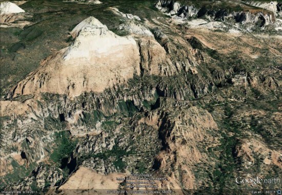
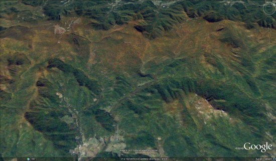
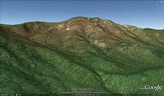
  • United States: California (Beales AFB, Linda, Palmdale, Rosamond, Yuba City), Florida (Apalachicola, Daytona Beach, Gainesville, Jacksonville, Kissimmee, Panama City, Pensacola), Georgia (Valdosta), Illinois (Findlay, Galesburg, Neoga, Taylorville), Louisiana (New Orleans), Mississippi (Jacksonville), South Carolina (Charleston, Hartsville, Lancaster), Texas (Beaumont, Corpus Christi, Freeport, Galveston, Texas City), Utah (Halchita, Mexican Hat, Zion National Park) — thanks ‘Andreas’ and ‘Munden’

Shenandoah National Park

On July 3rd, Shenandoah National Park in Virginia will turn 75 years old, and the official celebration just took place over the weekend. With that in mind, we thought it’d be a good time to take a look at the park. NASA has just released an image taken last fall at the height of leaf-peeping season, as autumn is one of the more popular times of year at the park, and it’s quite an awesome image.

shenandoah-leaf.jpg

To see that image for yourself in Google Earth, simply load up this KML file .


While you’re there, take some time to explore other areas of the park. The celebration occurred at Big Meadows (KML ), a popular gathering spot for people that travel down skyline drive. The Appalachian Trail passes right near Big Meadows as part of its 2181 mile stretch as well.

Another popular destination in the park is Old Rag Mountain, which reaches a height of 3291 ft (KML). Thanks to Google Earth’s new mountain features, it also showcases a tour that gives you a brief spin around the mountain.

old-rag.jpg

Have any of you had a chance to visit Shenandoah yet? If so, what was your favorite part of the park?

Learn more about the US Presidents by using Google Earth

Today is “President’s Day” in the United States, and Google has built a pretty neat site using the Google Earth Plug-in to show off information about all 44 presidents that we’ve had in the US.

jfk.png

You can view it for yourself in the U.S. Presidents Showcase page, which uses the Google Earth Plug-in and various tours to show you around. If you’d rather just explore the information on your own, as seen above, you can use this KMZ file to see them in Google Earth.

In their President’s Day blog entry, Google also points out a few other presidential items to explore in Google Earth, such as:

• A quick tour of the White House in 3D (KML)

• Valley Forge National Park (3D Warehouse)

Beyond those, here are a few other Presidential Google Earth Resources:

• The tour of all 50 State Capitol buildings, as many of the U.S. Presidents were state Governors at one time.

• Grave site locations for many of the Presidents (KMZ, via Google Earth Hacks)

If you know of other great resources to help educate on President’s Day, please leave a comment below and let us know about them!