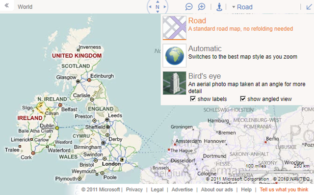
Microsoft have made some changes to the look and feel of the http://www.bing.com.maps site. So, it’s out with the old:
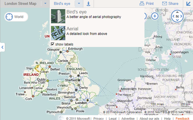
And in with the new:
The compass and zoom buttons are now overlaid as buttons on the map image rather than being in the toolbar header, and have been placed on the right hand side and made more prominent.
The breadcrumb trail has also been moved onto the map display itself, with a prominent target icon (displaying “World” in the screenshot above).
The streetside guy is still in the header although still doesn’t do anything yet (not if you’re in Europe, anyway).
However, the most interesting change for me is that the map styles themselves have been split into two separate dropdown categories – “road style” maps (Road, Ordnance Survey, Collins Bartholomew) and “aerial style” maps (Birds’ eye, Aerial). What’s more, the “show angled view” checkbox is gone, and the aerial map styles have reverted to their old names of aerial (for the top down imagery) and bird’s eye (for the oblique imagery).
This I think is a major improvement, and one which I hope feeds through into the Bing Maps AJAX v7 control soon. The problems with the old naming used on bing.com/maps (and still used the API) are many:
Firstly, there is terminology – when users say “birdseye” what they mean is the oblique, low level photographic imagery. They don’t say “birdseye angled” and “birdseye not angled” to refer to top down aerial imagery. This makes it hard to establish exactly what mode is being referred to.
Then, there are legal issues. In Microsoft’s own terms of use, there are specific restrictions placed on the use of “bird’s eye imagery” – http://www.microsoft.com/maps/product/terms.html – but what they really mean is “birdseye angled view” (i.e. true birdseye), not what you get when you just click the “birdseye” button, which gives you aerial view unless you checked the angled view button.
There are also technical differences – you can’t display custom tile layers over birdseye angled views, whereas you can display them over birdseye non-angled views (i.e. aerial) for example.
Birdseye and Aerial are two different map styles so it’s good to see they are being treated, and named as such on bing.com (as they always used to be!). So, when are these changes coming to the AJAX API?


