Travel as a Roman

Stanford University have created a “Geospatial network model of the Roman world”
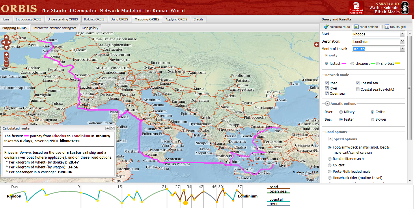
Impressive Interactive Map that can calculate  travel times and cost (in Denarius)
ORBIS, can calculate journey times between 751 locations in the Roman world. The site draws data from The BarringtonAtlas of the Greek and Roman World which has  been georeferenced by Cambridge University Students. To calculate voyages on water, the site uses maps of rivers. Sea journeys are also possible, with routes calculated from the Romans’ preferred sea routes. Dijkstra’s pathfinding algorithmis applied to calculate routes.
The Mapping tool also calculates route dependent on the month for a journey, as weather conditions at sea and on land had a major impact on ancient travel times.
Users can choose from a menu of transport/travel options:
  • Foot/army/pack animal, mule cart/camel caravan
  • Military March (Rapid)
  • Ox & cart
  • Fully loaded mule
  • Horseback rider (routine travel)
  • Private travel (routine, vehicular)
  • Private travel (accelerated, vehicular/horseback)
  • Fast carriage
Try the Roman Travel Interactive Map:
Information on the Geospatial Technology used is see the section tabs:
Building ORBIS: Multi-modal network model via the Building ORBIS tab and selecting the Geospatial Technology Tab.
via:mapperz.blogspot.com

Google Earth: The ancient and modern Rome

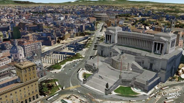
Rome really is an eternal city. With a history spanning over 2500 years and regimes from the early kingdom, through the republic, the empire, and later as the heart of the Catholic faith in the Vatican city, each has made their mark on the current urban architectural landscape of Rome. Now, with the release of thousands of new 3D buildings for the city, you can explore the blending of the ages in layered construction of Rome from within Google Earth. Let’s start our exploration in the ruins of the ancient Roman forum, home of the original Roman republic. From here we can easily travel to some of the subsequent Imperial buildings such as the Colosseum (AKA the Flavian Amphitheater) and Trajan’s Market and Column.

Looking towards the Colosseum through the Roman Forum

Next, we’ll head Northwest, towards the Pantheon and Piazza Navona. The Pantheon is a great example of the layered reuse of buildings in Rome; originally built in the Republican period, the Pantheon was retrofitted with the front portico in the Imperial period, and then later converted into a church. The shape of Piazza Navona also displays its historic foundation as the site was originally the Stadium of Domitian in the Imperial era.
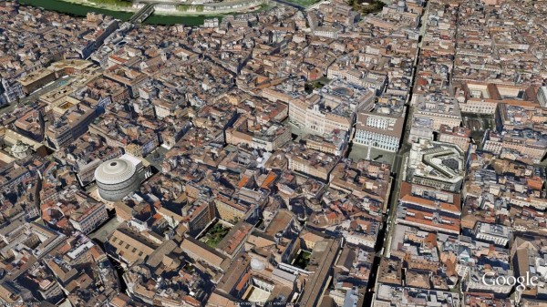
Central Rome showing the Pantheon and Piazza Navona

Lastly, let’s head over to the Vatican City, where we can see great examples of the Renaissance and Baroque architecture of the city in Saint Peter’s Basilica and the colonnade by Bernini around St. Peter’s square.
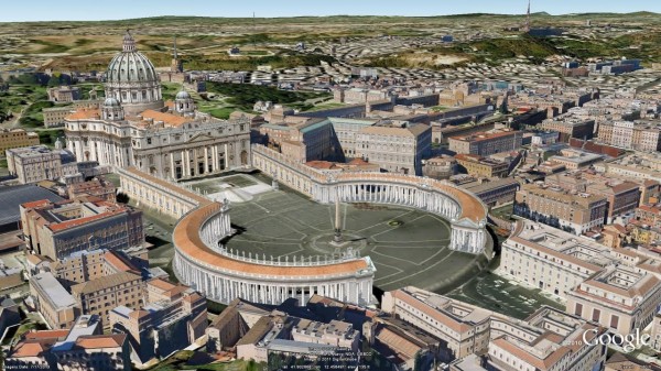
St. Peter’s Basilica and Piazza in Vatican City

There is much more to explore in Italy’s modern capital, so have a look around this beautiful city!
Paul on Extra Effort

“Whatever you do, work at it with
all your heart…

–Paul the Apostle

Colossians 3:23

Easter is the No. 2 top-selling candy holiday (behind Halloween) according to the National Confectioners Association. Each day, in preparation for the holiday, candy makers produce 5 million marshmallow chicks and bunnies. Each year, they produce 90 million chocolate bunnies and 16 billion jelly beans.

The reason the date of the celebration changes each year dates back to 325 A.D. It was set under the Roman emperor Constantine as the first Sunday after a full moon following the Spring equinox (that’s right… a full moon and an equinox). That makes it between March 22 and April 25 every year.