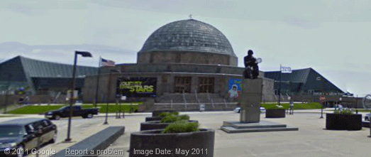
The Google Earth Blog noticed that Google Maps Street View images now come with a date telling you when the panoramas were taken.
If you look at the bottom left hand corner of a Street View image you can now view the month and year when the picture was taken.
Another nice little feature I’ve noticed Google Maps testing recently is the highlighting of search results. For a while now when you search for a location in Google it has shown a map with the searched area highlighted. Google have been testing this feature in Google Maps as well.
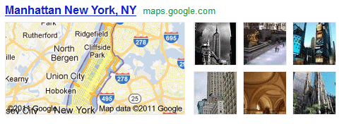
This feature still seems to be very much in the testing stage. I noticed the feature was working this morning but this afternoon it no longer seems to be working for me.
Finally, in Chrome (but not in Firefox and IE for me) the satellite button in Google Maps now shows the satellite view directly beneath the button.
via:googlemapsmania
