Google Earth Engine

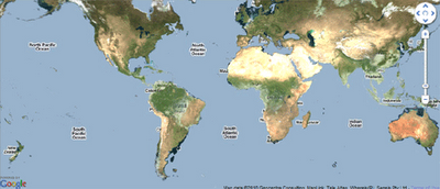
Image from Google Maps Mania
Google Earth Engine uses Google Maps and Google Earth to present satellite imagery and current and historical data to enable global-scale monitoring and measurement of changes in the earth’s environment.
Using Earth Engine you can browse though the data catalog and select to view satellite imagery from MODIS and Landsat 5. If you then select ‘workspace’ you can view the satellite imagery overlaid on Google Maps.
Each satellite imagery data set comes with a timeline slide control, so you can select the date of the imagery you wish to view. The Map Gallery section allows you to browse through maps created by Google’s launch partners and the Earth Engine team.
Cross-Posted from Google Maps Mania
http://googlemapsmania.blogspot.com/2010/12/google-earth-engine-launched.html

