Google Earth: Imagery Update Last Week of August

The Google Earth and Google Maps Imagery Team just published a new batch of aerial and satellite imagery, and as always, there’s all kinds of fascinating sites and features to check out.

We’re now deep into the dog days of summer. When I was growing up in Chicago, my siblings and I would be acting a bit stir crazy by this time in our summer breaks. So what did our wise parents do? They’d pile us into the confined space of the family car and proceed to road-trip it for a few weeks. My parents are history buffs, so our destination spots were typically of historical significance. To commemorate these fond memories, in this post we’ll look at locales seen in our newly published imagery that would typically fit the destination profile of my family.

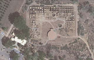
Our first example seen below is from high-resolution aerial imagery acquired this past June. The locale is a U.S. National Park located in San Juan County, New Mexico and contains 11th to 13th century structures constructed by the Anasazi Indians, the ancestors of the more commonly known Pueblo Indians. This site is included in the UNESCO list of World Heritage Sites.

Aztec Ruins National Monument, New Mexico

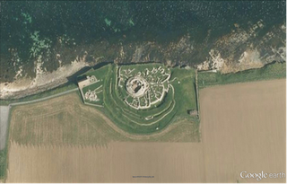
Family vacations outside of the U.S. happened on occasion and when they did, my dad’s fondness for Led Zeppelin would often lead us to any castle or related ruin in sight. In this aerial image, we can see the Broch of Gurness village located on the northwestern coast of Mainland Orkney, Scotland. The top of the central, circular broch structure has collapsed, and we can see the settlement remains that encircle the broch. The site dates to at least 60 AD.

Broch of Gurness, Scotland

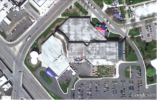
Finally, if we were good children and did not get our peanut butter sandwiches all over the car upholstery, we might be treated to visit a place such as the National Toy Hall of Fame, located in the Strong National Museum of Play, Rochester, New York. Some of the 47-and-counting enshrined toys include road-trip friendly icons such as the stick, cardboard box, ball, and of course Silly Putty!

National Toy Hall of Fame, Rochester, New York

Do you have a place you love for which you’d like to receive a notification when the Earth and Maps Imagery team updates the site? We’ve got just the tool: The Follow Your World application!

As always, these are but a few examples of the types of features that can be seen and discovered in our latest batch of published imagery. Happy exploring!

High Resolution Aerial Updates:

USA: Abilene, TX; Avenal, CA; Bakersfield, CA; Big Spring, TX; Bowie, AZ; Buckeye, AZ; Carlsbad, NM; Casa Grande, AZ; Columbia, MO; Dalhart, TX; Dayton, OH; Des Moines, IA; Farmington, NM; Ft Worth, TX; Joplin, MO; Junction, TX; Monahans, TX; Nogales, AZ; Omaha, NE; Paducah, KY; Payson, AZ; Rochester, NY; Sacramento, CA; Sioux City, IA; Tulsa, OK; Visalia, CA; Wilcox, AZ

Scotland: Aberdeenshire, Clova, Islay, Jura, the Orkney Islands, and the Shetland Islands

Sweden: Dalarnas Län, Gotlands Län, Norrbottens Län, Oland, Örebro Län, Västerbottens Län, and Västernorrlands Län

Countries/Regions receiving High Resolution Satellite Updates:

Albania, Algeria, Angola, Antarctica, Argentina, Armenia, Australia, Austria, Azerbaijan, Bahrain, Bangladesh, Benin, Bhutan, Bolivia, Bosnia and Herzegovina, Botswana, Brazil, Bulgaria, Burkina Faso, Burundi, Cambodia, Cameroon, Canada, Cape Verde, Central African Republic, Chad, Chile, China, Colombia, Cuba, Côte d’Ivoire, Democratic Republic of the Congo, Djibouti, Dominican Republic, Ecuador, Egypt, Equatorial Guinea, Eritrea, Ethiopia, Fiji, Finland, France, Georgia, Ghana, Greece, Greenland, Guatemala, Guinea, Guinea-Bissau, Honduras, Hong Kong, Iceland, India, Indonesia, Iran, Jamaica, Japan, Jordan, Kazakhstan, Kenya, Kuwait, Laos, Lesotho, Liberia, Madagascar, Malawi, Malaysia, Mali, Marshall Islands, Mauritania, Mexico, Mongolia, Morocco, Mozambique, Myanmar, Namibia, Nepal, Netherlands Antilles, New Zealand, Nicaragua, Niger, Nigeria, North Korea, Norway, Oman, Pakistan, Panama, Papua New Guinea, Paraguay, Peru, Philippines, Poland, Republic of the Congo, Romania, Russia, Rwanda, Saudi Arabia, Senegal, Serbia, Singapore, Somalia, South Africa, South Korea, Spain, Sri Lanka, Sudan, Svalbard, Sweden, Switzerland, Syria, Tanzania, Thailand, Togo, Turkey, Turkmenistan, Uganda, Ukraine, United Arab Emirates, United Kingdom, United States, Uruguay, Venezuela, Vietnam, Wallis and Futuna, Western Sahara, Yemen, Zambia, and Zimbabwe
Google Earth: Imagery Update – Week of May 2nd

The imagery update is now live in Google Earth and will be live soon in Google Maps. To see the places around the world that we’ve updated this time around, please download this KML.

The Google Earth and Google Maps Imagery Team will be publishing the latest batch of imagery in our next update, and as always, there are numerous fascinating and notable areas around the world.

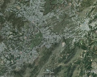
One of the areas that was already slated for this regular update is Abbottabad, Pakistan, which is of particular interest given yesterday’s news. The imagery of this area that is currently available in Google Earth and Maps is from 2005. Higher resolution imagery taken in May 2010 has been prepared for our next imagery update release. However, given the number of inquiries we have received about this area, and to help users better understand recent events, we’ve published an advanced preview KML of the new imagery for viewing in Google Earth. This imagery will be pushed live in Google Earth and Maps as part of our next periodic imagery update.

In addition, as part of our continued effort to provide up-to-date imagery, we’ve worked with our provider again to obtain even fresher satellite imagery of Abbottabad, Pakistan from this morning local time. We have provided this imagery, which is of lower resolution than the scheduled update, to the media. This imagery will be accessible in the near future through the Historical Imagery feature of Google Earth.

This round of imagery also includes many other interesting sites, a few of which are shown below.

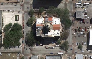
Here’s an image of the Harris County Court House of 1910, located in downtown Houston, Texas. Here you can see the ongoing restoration of the building, returning to glory its halls of justice. It is one of the most important historical buildings in Houston, and is often considered one of the best examples of historic courthouses in Texas.

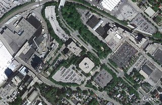
Below is an image of part of Milwaukee, Wisconsin. In it you can see two industries that are part of the might of Milwaukee: the Harley Davidson factory (right hand side of image) and the Miller Brewing Company (left hand side of image).

Now here’s a colorful sight: the Clipsal 500 Adelaide race, a four-day event consisting of two 250 km races of V8 Supercars. The race is often attended by well over a quarter million people. This photo shows the race in March 2010.

These updates will be made available soon in both Google Maps and Google Earth.

High Resolution Aerial Updates:

USA: Brookshire, TX; Brownsville, TX; Dallas, TX; Ft Stockton, TX; Hebbronville, TX; Houston, TX; Laredo, TX; McAllen, TX; Milwaukee, WI; Padre Island, TX; Wharton, TX; Zapata, TX;

Australia: Central Coast, New Castle, and Salamander Bay

Norway: Buskerud, Fredrikstad, and Oslo

Countries/Regions receiving High Resolution Satellite Updates:

Algeria, Angola, Antarctica, Antigua and Barbuda, Argentina, Australia, Austria, Bangladesh, Belarus, Benin, Bolivia, Brazil, Burundi, Cameroon, Canada, Central African Republic, Chad, Chile, China, Colombia, Costa Rica, Croatia, Czech Republic, Democratic People’s Republic of Korea, Democratic Republic of the Congo, Denmark, Djibouti, Dominican Republic, Egypt, Eritrea, Estonia, Ethiopia, Finland, France, Georgia, Germany, Greece, Greenland, Grenada, Guadeloupe, Guinea, Haiti, Honduras, Hungary, India, Indonesia, Iran, Ireland, Israel, Italy, Japan, Jordan, Kenya, Kuwait, Latvia, Lebanon, Lesotho, Lithuania, Madagascar, Malawi, Mali, Mexico, Mongolia, Morocco, Mozambique, Myanmar, Namibia, Nepal, Netherlands, New Zealand, Niger, Nigeria, Norway, Oman, Pakistan, Paraguay, Peru, Philippines, Poland, Portugal, Republic of Korea, Romania, Russia, Saudi Arabia, Senegal, Serbia, Seychelles, Sierra Leone, Slovakia, Somalia, South Africa, Spain, Sri Lanka, Svalbard, Swaziland, Sweden, Switzerland, Syria, Taiwan, Tanzania, Thailand, The Gambia, Tunisia, Turkey, Uganda, Ukraine, United Arab Emirates, United Kingdom, United States, Uruguay, Venezuela, West Bank, Western Sahara, Yemen, Zambia, Zimbabwe

New Maps domains in 11 countries in Middle East & North Africa

With the growing numbers of Internet users in the region, we noticed that a huge number of search queries have a geographic component. So, we’ve been working on providing rich, local geographic data to offer you the best local experience possible and today we are announcing the launch of local Google Maps domains for 11 countries across the region.

Now, Google Maps will be easily accessible from your local search domain in Algeria, Libya, Egypt, Lebanon, Jordan, Kuwait, Bahrain, Qatar, UAE, Oman, and Saudi Arabia. You’ll also be able to use it in Arabic as well as English and French for some countries. You can use Google Maps to search for a city, navigate your way around towns, or find a local business. This could be a Falafel place in Amman, a hotel in Cairo, or a restaurant in Jeddah.

Having access to maps on your local domain is more than just finding your way from A to B. There are many ways that businesses and individuals can contribute to making Google Maps in your country more useful and more accurate. Check out some of the following features:

Use My Maps to create your own personalized maps, for example a customized map of your favourite places in your neighborhood to share your experiences with others.

Maps in Algeria, Libya, Kuwait, Bahrain and Qatar have been made possible in large part by passionate users mapping their countries via Google Map Maker, which is available across the world in more than 180 countries and regions. Map Maker allows you to use your local knowledge to practically edit the entire map – from roads, businesses, parks, schools and more. Users have mapped out entire countries or just made their neighborhoods look stunning. Starting today Google Map Maker is now launched in Saudi Arabia and the United Arab Emirates.

It is also possible to include a Google map on your own website. You can display information – like a restaurant location or directions – on a Google map and embed it in your website using our Google Maps API. There are many great sites already using the API to share customized information on Google maps. For the developers and webmasters amongst you, the possibilities are endless.