Bing Maps: A New Look for Pushpins, Popups, and Transit

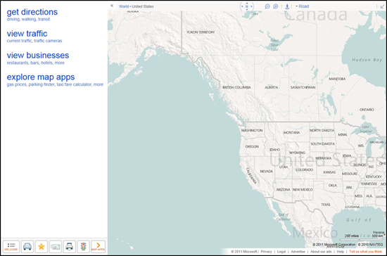
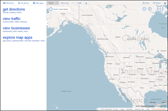
Bing Maps  just rolled out some exciting new updates to www.bing.com/maps that make it easier for you to find information on the map, explore the layouts of over 850 venues, as well as get to where you’re going with public transit (or transport). Read on to learn more!

Pushpin and Popup refresh

The pushpin. It’s the most common element overlaid on a map. And today, it’s getting an update. In making these changes, to both the pushpin and corresponding popup, our goals were simple: enable you to find the information you want, more quickly and efficiently, while at the same time minimizing obstruction of the map. Let’s take a deeper look at some before and after examples.

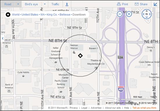
The updated pushpins are designed to better overlay on top of our base map color scheme and make it easier to find results when you perform a search. Search related content appears in blue, while user-generated and saved content (such as “My places”) use an orange colored pin. The contrast changes are more pronounced on hover (and for business searches, the corresponding item in the left-hand panel is adjusted as well), and we’ve also added a new small popup to tell you the name or location or the pin you’re hovering over. Now it’s much easier to quickly scan a bunch of pins to see what they are.


When you click to select a pin, it actually shrinks so as to expose more of the map underneath, and unveil our streamlined popup. Here, we’ve made a number of changes to more compactly display the relevant business or location information and stand out against the backdrop. The most popular actions available for each item have been simplified and consistently placed at the bottom. For most users (except those in the UK), the interaction has changed from a hover-only model to a click-based model for showing the full popup contents. (For users in the UK, where you already had to click to see the popup, we’ve simply added the new smaller hover popup in addition to the layout and style changes.) Overall, these improvements allow you to keep a popup visible while panning/adjusting the map, and even hover over other pins to see what they correspond to, ultimately making it easier for you to find the place you want more efficiently.


One final change you may have noticed is that the pushpins and popups dynamically adjust based on the current map style in order to ensure the information does not get lost on the map.


Enhanced Transit Experience

Public transit (and UK transport) users will find a handful of subtle improvements to our directions experience that make it easier to get where you’re going, and make sure you’re on the right line to get there. We’ve changed the way we represent each transit line to better reflect the actual colors and signage used by the line, both for our US and UK markets. You’ll see this reflected both in the on-map waypoints as well as our enhanced directions list.


More sharing options

We’ve also extended our ability to send directions to your mobile phone (via SMS) to support transit directions. This functionality is accessible via the “Send: Mobile” link at the bottom of the directions panel. You’ll receive a link on your mobile phone which loads the directions on m.bing.com, and works for all devices which can access m.bing.com (unfortunately, Windows Phone does not currently support transit).


Drag to modify your route

Users can now easily modify their directions routes by clicking and dragging on start, end, or waypoints. You’ll see a helpful tooltip appear when you hover over an element that can be adjusted simply by dragging and dropping—and the route will be recalculated automatically!

Explore venues

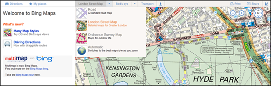
Did you know Bing Maps now has over 850 venue maps of airports, malls, shopping districts, and more? Browsing through them is now easier than ever! Just click on the “explore venue maps” link on Bing Maps, or visitwww.bing.com/maps/venues to get there directly, to browse a categorized listing of available venue maps. You can filter them by country, sort them by location (or alphabetically), and browse through them spatially on the map. If you want to have your venue be part of Bing Venue maps, please contact us for details.


We’re excited about this next step in the evolution of our visual design and believe it is a big step forward for simplifying user interaction with the map, and helping users find the information they want quickly and efficiently. We’ll be rolling out these changes to bring consistency across the broader Bing network over the next few weeks.

Bing Maps with a new user interface


Over the past few months, we’ve been testing some enhancements to the Bing Maps interface that we’re excited to now make available for everyone. The most apparent changes are to our task and navigation controls, where—based on your feedback—we’ve made it easier to find the most common actions to complete your task at hand.

For reference, here’s the previous design (pay particular attention to the top and bottom of the page):


Here’s the refreshed version:


We’ve consolidated actions that were previously scattered throughout the page, and concentrated them along the top, where you expect to find them. We’ve included text labels for most of the buttons. And, most importantly, we’ve focused on making the controls accessible while still allowing the map to be the focus of the page.

These improvements are being rolled out to all of our international sites with appropriate market-specific functionality. For example, Bing Maps users in the UK will still have access to the London Street Map and Ordnance Survey styles, along with our standard Road map, via the vector style drop-down. The public transport overlay, showing tube, DLR, and tram networks, is also readily available from the navigation bar when the map is centered over the greater London area.]


You’ve told us you love our unique Bird’s eye 45-degree perspective, viewable from all four compass directions, as well as our high resolution Aerial imagery (see the recent blog post on the Global Ortho Project for more details). As a result, we’ve improved access to these imagery types by making them directly accessible from the top of the navigation bar. At the same time, you can now more easily switch between various road and imagery styles with a single click. You also have the option to view either of the imagery styles with or without labels, depending on your preference.


TIP: Automatically center the map on your current location

If you’re visiting Bing Maps with a browser that supports the W3C Geolocation API, you’ll find a new button (calledlocate me) available to the left of the breadcrumb that, when clicked, will center the map on your current location as reported by your browser.


You’ll receive the highest accuracy results—including a pin and approximate radius—when using a computer with WiFi enabled. You can turn off the pin by clicking the button again. (Note: all browsers will prompt you to share your location after you click the locate me button; if you choose not to allow access, Bing Maps will be unable to center the map on your location.)


We hope you find these changes make Bing Maps simpler and more efficient to use as you focus on completing your map-focused tasks!


Bing Spatial Data Services – Next Gen Spatial Search Comes to the Bing API

In August of 2001, we released the MapPoint Web Service that introduced spatial search and data hosting capabilities for our users. Since then, large and small businesses, government agencies and non-profits have used the service to support geospatial functionality such as store locators, fleet tracking, and real estate applications for their customers.

Today, we launched Bing Spatial Data Services, adding next generation spatial search to the Bing API offering. This release offers the benefits of cloud hosting and distributed computing, allowing customers to upload their data to our servers and perform spatial queries under the umbrella of their existing Bing Maps License.

Here’s a little more detail about what the service does and how it works.

Geocode Dataflow API (Batch Geocode):

  • Use it to batch geocode large sets of data (upload a process a then download)

Data Source Management API (Load):

    • Use to load, manage (update, delete) data for long term hosting.
    • Data can be in a file or a Windows Azure™ Blob Service location.
    • Load is required before being able to query with Query API.

Query API (Spatial Query):

    • Used to query hosted data; a query response can contain a maximum number of 250 results (the new Bing Maps AJAX v7 makes light work of displaying large numbers of points on a map)

By Area <aka FindNearby>:

· Either specify a center point (radius search) or bounding box to search for matching entities. Use built in filters to refine the response. Results are “as the crow flies”. Example:

How many matching entities fall within this specified area (circle or rectangle)?

By Property:

· Search a hosted data source for one or more entities by specifying property values. Example:

Return all entities (customers) with sales person John Smith.

By ID:

· Specify an entity ID and receive in response all related information for the given entity. Example for Contoso Corporation:

For entity of ID “Contoso Store 1200”, return all associated property information (store #, address, open times, WiFi, etc)

For entity of ID “Contoso’s Best Coffee Store 5”, return all associated property information (store #, address, open times, WiFi, etc)

For more details, you can check out our documentation, or sign up for our upcoming webcast on March 1st. Try it out and let us know what you think.

Max Artemov
Senior Program Manager
Bing Mobile