The California Bay Area, now in 3D

Nearly five years ago, Google embarked on an ambitious project to work with everyday users like you to create a 3D model of every building in the world for Google Earth. We’ve made strides toward our goal adding millions of buildings to the 3D layer of Google Earth in cities across the globe. And today, we’re pleased to announce another big step in that direction with the release of expanded 3D coverage of the California Bay Area (which also happens to be the homebase of Google’s headquarters!).

With Google Earth’s “3D Buildings” layer turned on (or by using the Earth View in Google Maps), you are now able to tour tens of thousands of new buildings in the 50-mile stretch between San Francisco and San Jose, as well as select areas of the East Bay, like Oakland and Berkeley. You can now fly through the air and view urban centers of cities like Foster City, Mountain View, Palo Alto, Oakland, Redwood City, Santa Clara, Santa Cruz, San Mateo, and Sunnyvale, in 3D.

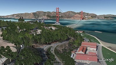
If you’ve never been to the Bay Area, start by visiting iconic landmarks like the Golden Gate Bridge and the Ferry Building (note: you will need to have the Google Earth plugin installed to view these links). While in San Francisco, you may notice that in addition to 3D buildings, there are also 3D trees throughout the city. This is a new feature we released with Google Earth 6.0, and San Francisco is one of the first few cities to showcase 3D trees.

The Golden Gate Bridge and 3D trees

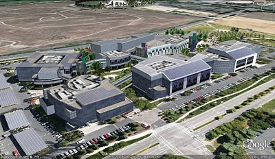
The Bay area peninsula is also the home of Silicon Valley. Several technology companies are available to view in 3D, including of course, the Googleplex in Mountain View.

Googleplex in Mountain View, CA

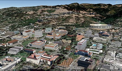
Sports fans might be interested to check out the HP Pavillion, where the San Jose Sharks play, as well as AT&T Park, home of the 2010 worldseries champion, SF Giants. Music lovers may also want to view the Oracle Arena in Oakland and Shoreline Amphitheatre in Mountain View. If you’re starting college soon, take a virtual tour of the Stanford and UC Berkeley campuses.

UC Berkeley Campus

Of course, this is just a small sample of the several thousands of buildings you’ll find in the area. You can check out an expanded tour we created, or you can open up Google Earth and explore for yourself. As you go on your virtual tour, you may notice that several buildings were created by users, who continue to be an integral part of our 3D building efforts. For example, supermodeler, PeterX created nearly 1,000 buildings around the Bay Area, including the NASA Ames Research Center.

PeterX’s model of the wind tunnels at the NASA Ames Research Center

If you’d like to get involved in modeling your town (or any other location), we have several free (and easy!) tools to get you started. With Google Building Maker, you can create and contribute a building in as little as 10 minutes. And if you’d like to refine your building, bring it into Google SketchUp for fine-tuning.

Everyday, we are working on adding more 3D cities to Google Earth as part of our larger mission to organize the planet’s geographic information and make it accessible to all.

Happy touring!
A geo-modeling competition in Poznań, Poland

Cities are exploring creative ways to get themselves on the virtual map. Some, such as Chula Vista, California are asking local residents to help. Others, like Mishawaka, Indiana and Poznań, Poland are running contests with cash awards to entice modeling support. While the approaches vary, what’s clear is that cities see the value of a digital representation that is publicly available on Google Maps and Google Earth.

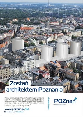
The City of Poznań announced the results for its competition last week. The goal of the organizers (as outlined on the competition web site) was to model specific buildings on the old imperial route through the city. The route contains lots of heritage buildings that the city is eager to promote, including royal palaces, opera houses, the old market area, and other historic buildings.

The competition poster for Poznań’s geo-modeling competition

The Poznan competition was uncharacteristically short – November 22 through December 19 – interested parties had to act fast. Word of the competition quickly spread to others in the geo-modeling community. Entrants possessed a range of experience, but (not surprisingly) several experienced geo-modelers participated. These included Marcin Kruk (nevermor) and Supermodelers Filip Michałowski (Athinaios) and Tomasz Szular (tomcioZG).

The city hasn’t indicated how many entries were received, but it recently announced the winners. Entries were received from as far away as the United States. The competition was supported by the local Google office, who provided prizes to the winners in addition to the cash prizes that were awarded by the city.

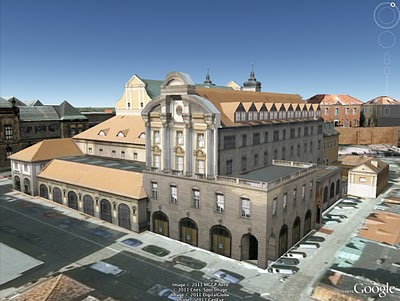
Church of St. Anthony of Padua (Kościół św. Antoniego z Padwy) by Zuzanna Kurzawa

Local geo-modeler tomcioZG had this to say about the competition: “I’m happy with this contest and glad that someone in Poland is trying to organize something like this. I only wish the duration were longer – I submitted my last model seven minutes before the end of the competition!”

He went on to say: “I know that this competition was to determine interest, and I think City Hall should be pleased with the result. I checked all the models and they are made really well. After the competition I spoke with an employee of Poznań City Hall, who told me that if all goes well, they will hold this year a new contest.”

The city is still in the process of publishing the models to the 3D Warehouse. Some of the results can be found in this collection.

Photo-rendering with Shaderlight

If I had a nickel for every time someone asks me which renderer they should use with SketchUp, I’d have a fleet of helicopters perched on the turrets of my castle. One look at SketchUp’s Fan Photos page on Facebook is all you need to understand our community’s obsession with delicious photo-realism. There are piles of fantastic rendering tools to choose from, and more become available all the time. Happily, most of them have a “free mode” that you can use to try things out.

Shaderlight, an awfully-impressive (and relatively new) offering from ArtVPS, is one such rendering tool. Its interface is clean and straighforward, there’s a free version available and the video tutorials are easy to follow and comprehensive. It’s currently only available for Windows, but I’m told that a Mac version is in the works. Here are some tasty sample renderings to whet your appetite:

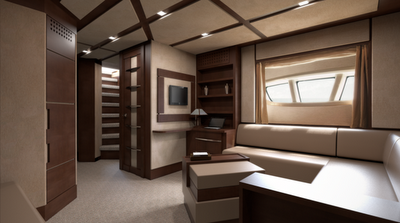
Boat interior rendering by Sully114

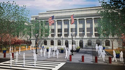
Rendering by Daniel Tal
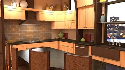
Kitchen rendering by Eric Schimelpfenig
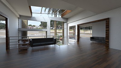
Villa interior rendering by Sully14

In the interest of fairness to all of our rendering friends, our plugins page lists some of the other tools you can investigate if photo-realism is your bag.