Sudan is preparing to vote on January 9 to decide if the South will become independent from the North. The referendum is part of the Comprehensive Peace Agreement signed in 2005 ending the Civil War, which lasted 22 years and led to the deaths of an estimated 2 million people. Analysts fear the possibility of renewed violence.
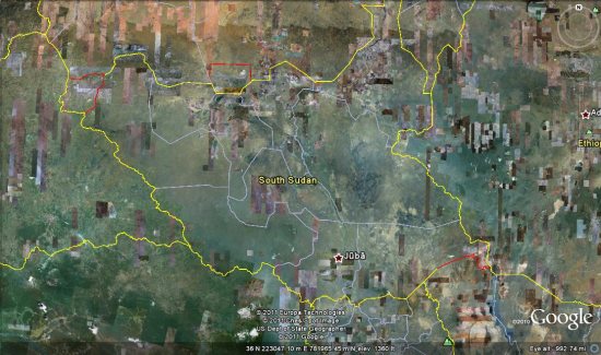
Sudan is a huge country (2.5 million km2), with an estimated population of 44 million people, but it’s poorly mapped. Without basic geospatial information, it’s difficult for humanitarian agencies and first responders to monitor and evaluate the risks and current needs, target their efforts, and mobilize proper resources. At times like these, it is critical to have good maps on roads, settlements, voting stations, hospitals, buildings and other services – with both local and official names – to generate better, faster responses.

This is one of the goals of the Satellite Sentinel project, which is using imagery, field reports and Google Map Maker to conduct human rights monitoring along the border between North and South Sudan. This effort is the result of an unprecedented collaboration between Not On Our Watch, Google, the Enough Project, the United Nations UNITAR Operational Satellite Applications Programme (UNOSAT), the Harvard Humanitarian Initiative, and Trellon, LLC.
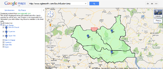
If you have knowledge of Southern Sudan, an interest in mapping, and some free time, we encourage you to join the effort. With tools such as Google Map Maker and Sudan Vote Monitor, you have the opportunity to take concrete action by improving the map, helping to monitor and report human rights violations in near-real time and providing insight into the socio-political climate prevalent in the country and region.
Global Call for Action:
Together let’s build a better map of Southern Sudan. Your local knowledge and mapping contributions of schools, hospitals, and landmarks will be extremely useful to the humanitarian community to quickly build a picture of the situation, especially in these areas of interest.
Items that you can map:
- Towns and town names (Arabic and local names especially)
- Roads (in-town roads as well) and trails
- Displaced persons camps
- Cultural landmarks
- Geographic landmarks
- Schools
- Orphanages, shelters etc.
- Hospitals
- Community centers
- Border crossing points
- Nomadic camps
- Markets and large cattle gathering points
This is an opportunity to utilize the power of community engagement through mapping. We welcome you to get acclimated to Map Maker through our Getting Started page, and then invite you to join our Sudan-specific discussions.