Ingres Db

The latest version of Ingres relational database now also includes support for geospatial data. GIS functions and spatial data types are included out-of-the-box (i.e. do not require additional plug-ins) and make it easy to enable web mapping. Ingres 10S supports spatial applications, such as Esri’s ArcGIS for Desktop and FME but also MapServer and GeoServer.

Ingres 10S is supported by other programming libraries including GDAL/OGR and GeoTools, allowing import, export and manipulation of vector data. Ingres 10S leverages the GEOS geometry and PROJ cartographic projection libraries for manipulating and transforming spatial data between dozens of geographic and planar co-ordinate systems.

Ingres 10S is an open source, enterprise grade database, not as popular as MySQL or PostgesSQL but, as the other options, can be downloaded and used for free. Ingres was first created as a research project at the University of California, Berkeley in the early 1970s. Since the mid-1980s, Ingres has spawned a number of commercial database applications, including Sybase, Microsoft SQL Server, NonStop SQL, but also open source PostgreSQL (which with PostGIS extension is the most popular open source spatial database).

The Bing Maps Webcasts Now Open for Registration

The Bing Maps Platform from Microsoft enables organizations to easily and cost-effectively deliver geospatial content to the customers and businesses they serve. Not only does this optimize existing investments in GIS and imagery services, it allows organizations to save money using Bing Maps by making strong connections with customers and exposing relevant content easily on a map from Bing.

Register today to attend a webcast and learn more. Topics include:


What’s New in the Bing Maps Platform?  | February 16, 2012, 2pm Eastern time, 60-minutes

Attend this session for an overview of the latest capabilities in the Bing Maps Platform. You’ll learn the latest on the Bing Maps Imagery program, how to view the meta data and other features in the platform including the best portal to see the latest new imagery sets.


Using the BingMapsPortal.com and keys with Bing Maps Platform | March 15, 2012, 2pm Eastern time, 60-minutes

Attend this session and learn how to use the bingmapsportal.com, tips for using/hiding your Bing Maps key and other helpful development hints.


Bing Maps Spatial Data Services | April 19, 2012, 2pm Eastern time, 60-minutes

Attend this session and learn how to take advantage of the Bing Maps Spatial Data Services included with the Bing Maps Platform for data hosting and findnearby/bound box queries.


GIS with Google Earth and Google Maps

This session at Google I/O demonstrated how developers can take advantage of new and little known GIS capabilities in all of our geo services.

We started out showing some of the GIS capabilities in Google Maps API, which amongst other features, lets you calculate distances and angles and overlay map tiles in arbitrary projections.

Moving onto some new and upcoming products, we showed off some of the capabilities of Google Earth Builder, a new platform to manage and publish large amounts of raster and vector GIS data.

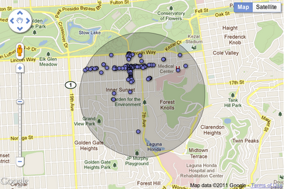
In the world of data visualization, previous sessions had showed off new styling features for Fusion Tables. In this session, we showed how you can enable spatial queries on your data, displaying maps and statistics for the closest set of features to a location, or all features within an arbitrary radius.

Google Earth Builder is not the only new product that provides access to our infrastructure for working with large GIS datasets – we also talked about Google Earth Engine. This Google.org project is designed to help scientists easily access massive archives of satellite imagery, and run image analysis and other algorithms on the data within Google’s datacenters. Complex analyses that might take months or years to run on a single machine can now be completed in hours or minutes.

Finally, we showed off some ways you can integrate open source technology, and finished off the session with Brian Flood from Spatial Data Logic, who demonstrated a great example of the kind of GIS services that developers can build using Google’s Geo API’s.

Check out the video to see for yourself, and thanks for reading our Geo API’s Summer Learning Series.