In this video we show how to use Microsoft MapPoint to import your customer list and create an optimized driving route.
In this video we show how to use Microsoft MapPoint to import your customer list and create an optimized driving route.
To foreigners, Paris is the “city of love.” To Parisians, it’s the “city of lights” (La Ville-Lumière). Today, Paris is the “city in 3D.”
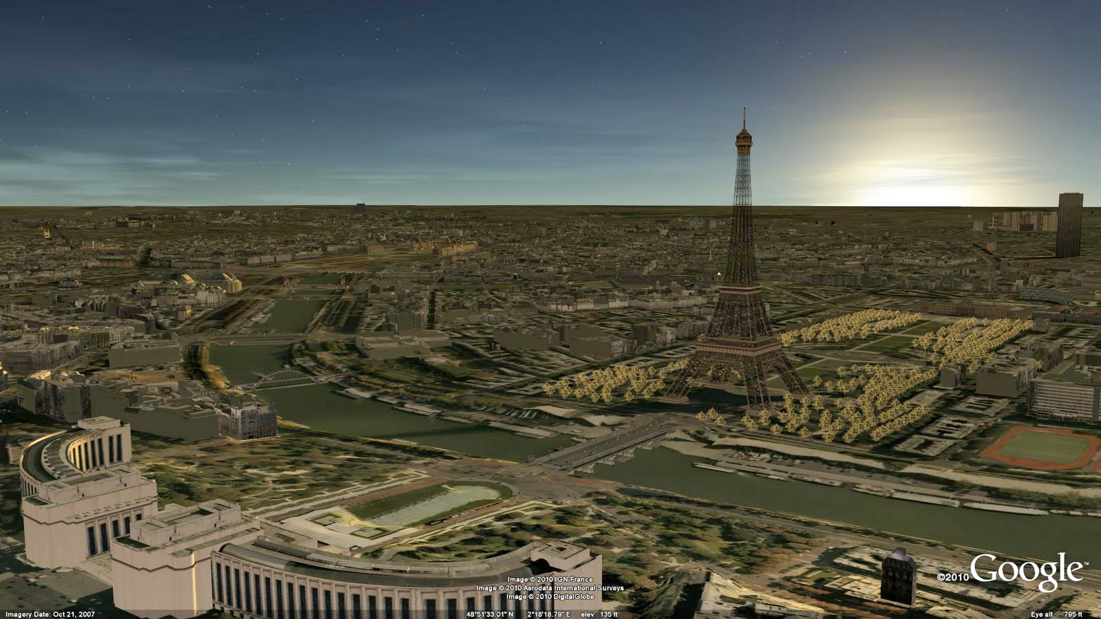
Often considered one of the top destinations for world travelers, Paris is known for landmarks like the Notre Dame Cathedral and the Arc de Triomphe, world-famous museums like the Louvre and the Musée d’Orsay, and hundreds of little bistros with French pastries so good they make your heart pop (literally and figuratively). Now all of these sites – and the many, many others that make Paris special – are available to tour in 3D in Google Earth.
With Google Earth’s “3D Buildings” layer turned on (or by using the Google Earth plug-in for Google Maps) you can wander the streets of the Montmartre district made famous by artists like Picasso, Van Gogh and Dalí from your living room. You can also see the Sacré-Cœur Basilica without having to climb the 237 steps to get there. Instead of waiting in line to see the view from the Eiffel tower, fly straight to the top in Google Earth and get a 360-degree view of Paris. Round out your tour by taking a peek at the Centre Pompidou, which turned the architectural world upside down (or perhaps inside out?) with its exposed skeleton and brightly colored building utilities.
Whether you’re an armchair tourist or planning your next vacation to France, take some time to tour the streets of the French capital and see the historic sites; after all, many of them were created by modelers just like you.
If you’d like to get involved in modeling your town (or any other location), we have several tools to get you started. With Google Building Maker, you can create and contribute a building in as little as 10 minutes. And if you’d like to refine your building, bring it into Google SketchUp for fine-tuning.
Happy touring!
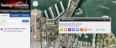
The first is called ‘Touring to Australia’ and is essentially free online trip and itinerary planner. It allows you to find places to stay and things to do and see on your trip. Just choose your destination and then select from a number of categories of markers to view on the map. You can select from accommodation, excursions, rental services, places of interest and activities. Whilst browsing the map you can add individual hotels and points of interest to your itinerary. Great tool for planning your next trip, business or private.
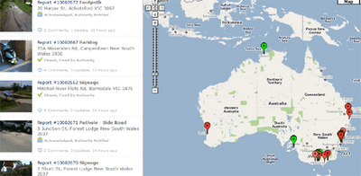
The second one is called ‘Neet Street’ and is a tool for reporting community problems which are then passed on to the appropriate authorities. Using Neat Streets you can report road obstructions, vandalism, potholes, fallen trees, abandoned trolleys, litter, and graffiti. You can download a Neat Streets application for the iPhone, Blackberry, and Android based phones. With the apps you can take pictures and submit community problems directly from your smartphone. The latest submitted photos and problems are displayed on a Google Map on the Neat Streets website home page. Neat Streets automatically forwards the reports to the appropriate authority based on the GPS location.