Bing Maps: Streetside

Bing Maps Streetside – London UK

Bing Maps Streetside - London UK

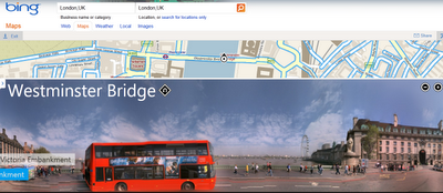
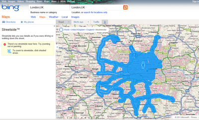
Streetside is now available for some parts of London, England

Bing Maps Streetside - Westminster Bridge London UK

Westminister Bridge, London Bus and London Eye Iconic Landmarks, but do not expect ‘Google Streetview’ type functionality this is more a slide-show of images.

More information on Streetside

http://www.microsoft.com/maps/en-GB/streetside.aspx

View Streetside – London UK (click the icon next to Traffic)
http://www.bing.com/maps/?v=2&cp=51.50085314131346~-0.12088798043215165&lvl=14&dir=0&sty=r&trfc=1&form=LMLTCC

The Map of London Marathon 2011

London Marathon 2011 Map


London Marathon 2011

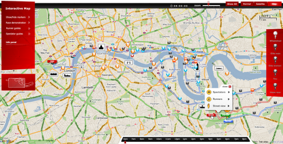
London Marathon Map 2011 – with StreetView

Racing starts 9.00am BST on Sunday 17th April 2011

9am Elite Women’s Race Starts
9.25am Wheelchairs Race Starts
9.45am Elite Men’s Race Starts
9.45am Mass Race Starts

London Marathon Map 2011 - Now with StreetView

Runner and Spectators can use the map to find locations around the course.
Use the interactive Timeline Bar to find out when lead runners go past.
Streetview is available now to view the location also.

London Marathon Map 2010 - Legend

Look out for Crowd Density Mapping – live on the race day

http://www.virginlondonmarathon.com/interactive-map/

One New change from last years 2011 map are
Road Closures are now included on the Interactive

Official Site:

http://www.virginlondonmarathon.com/

Interactive Map
http://www.virginlondonmarathon.com/interactive-map/

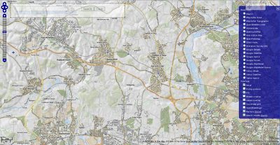
OpenLayers-based slippy map

Facilmap.org Beta is an OpenLayers-based slippy map that aims to combine useful geographical information, renderings and tools of different projects into one reusable and extend-able map.

Facilmap.org Beta

Some available layers (there are more)

  • Mapnik
  • Osmarender
  • OpenCycleMap
  • Minutely Mapnik
  • OpenStreetBrowser
  • Hike & Bike Map
  • OpenPisteMap
  • ÖPNV-Karte
  • MapSurfer Roads
  • MapSurfer Topographic
  • Ordnance Survey OS Streetview (UK only)

More information on this project:
http://wiki.openstreetmap.org/wiki/FacilMap

Source and Credit to Candid Dauth:
http://www.openstreetmap.org/user/Candid%20Dauth/diary/12723

Map
http://beta.facilmap.org